
PST100
ITRA
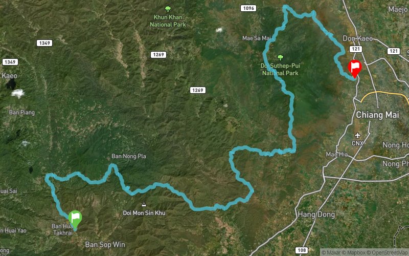
 107.84 km
4436 m
4522 m
107.84 km
4436 m
4522 m


Like
Favorites
Reviews
Share
GPX
10
PDF A4
PDF A0
Profile
Flyover
3D
Insert
Passages
Mae Ai (TH) Muang Chiang Mai (TH)
Effort kilometer
Longest ascent
Longest descent
152
1120 m
1330 m
Max. elevation
Min. elevation
Quality index
1517 m
326 m
 1pt/9m
An A-to-B adventure starting in Mae Wang Subdistrict, winding through forest trails, ridgelines, and farmland before finishing at CMECC in Chiang Mai. Well-stocked aid stations and cheerful local support make this long journey welcoming, even for first-time 100K runners.

Start
Distance
0 km
Altitude
418 m
D+
0 m
D-
0 m
107.8 km
4436 m
4522 m
Finish
Distance
107.8 km
Altitude
332 m
D+
4436 m
D-
4522 m
Click on a point of interest to display it on the map
Reviews and times
Add a track
Pocari Sweat Trail PST100

Track number : 311471
Link to track :
https://tracedetrail.fr/en/trace/311471
Log in to insert this track on your website
 Trace de Trail