
NPT55
ITRA
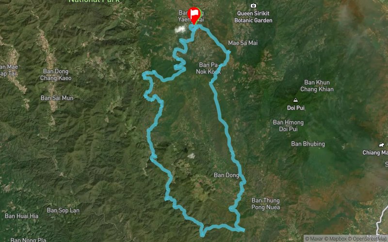
 57.16 km
2730 m
2742 m
57.16 km
2730 m
2742 m

NPT55 - Nin Prapa Trail

Like
Favorites
Reviews
Share
GPX
3
PDF A4
PDF A0
Profile
Flyover
3D
Insert
Passages
Weang Hang (TH) Weang Hang (TH)
Effort kilometer
Longest ascent
Longest descent
84
820 m
830 m
Max. elevation
Min. elevation
Quality index
1352 m
391 m
 1pt/11m
Immerse yourself in the heart river valleys and lush forests on a runnable, scenic course where nature takes center stage.

Start
Distance
0 km
Altitude
780 m
D+
0 m
D-
0 m
57.2 km
2730 m
2742 m
Finish
Distance
57.2 km
Altitude
768 m
D+
2730 m
D-
2742 m
Click on a point of interest to display it on the map
Reviews and times
Add a track
Pong Yaeng Trail NPT55

Track number : 310718
Link to track :
https://tracedetrail.fr/en/trace/310718
Log in to insert this track on your website
 Trace de Trail