
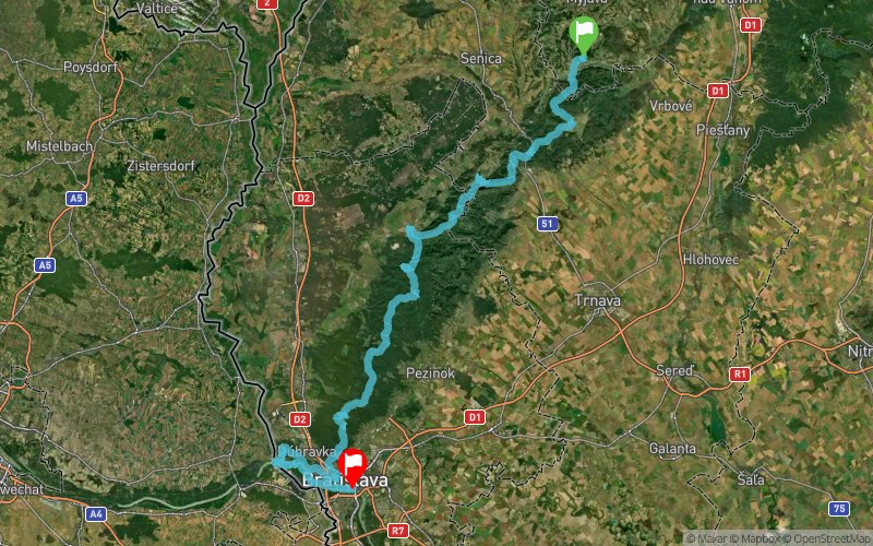
Stefanik Trail 2017 - 140K
ITRA
 144.2 km
5330 m
5680 m
144.2 km
5330 m
5680 m

Like
Favorites
Reviews
Share
GPX
9
PDF A4
PDF A0
Profile
Flyover
3D
Insert
Passages
Pustá Ves (SK) Bratislava (SK)
Effort kilometer
Longest ascent
Longest descent
197
520 m
540 m
Max. elevation
Min. elevation
Quality index
753 m
117 m
 1pt/17m
Run to the very heart of Europe, the capital od Slovakia, Bratislava city. Explore where the beauties of the region where Carpathian Mountains massif begins.

Start
Distance
0 km
Altitude
498 m
D+
0 m
D-
0 m
144.2 km
5322 m
5676 m
Finish
Distance
144.2 km
Altitude
144 m
D+
5322 m
D-
5676 m
Click on a point of interest to display it on the map
Reviews and times
Add a track
Stefanik Trail 2017 - 140K

Track number : 30260
Link to track :
https://tracedetrail.fr/en/trace/30260
Log in to insert this track on your website
 Trace de Trail