
CM2
ITRA
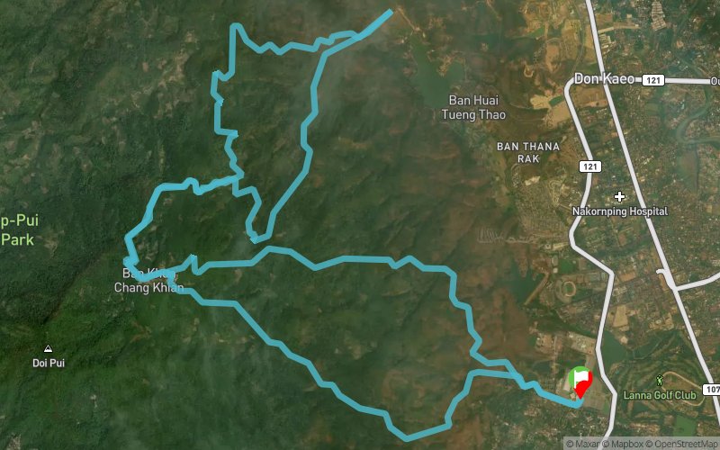
 39.08 km
2375 m
2375 m
39.08 km
2375 m
2375 m


Like
Favorites
Reviews
Share
GPX
7
PDF A4
PDF A0
Profile
Flyover
3D
Insert
Passages
Muang Chiang Mai (TH) Muang Chiang Mai (TH)
Effort kilometer
Longest ascent
Longest descent
62
1110 m
1060 m
Max. elevation
Min. elevation
Quality index
1375 m
332 m
 1pt/7m
Two climbs, two descents — deceptively challenging mountain running
Don't let the simple format fool you. CM2 delivers a proper mountain challenge through two significant climbs to the Hmong village headquarters, with technical descents that demand respect. The course features wide dirt roads and challenging single-track sections, making it perfect for competent road marathon runners seeking their first taste of serious elevation gain. This distance offers the right balance of accessibility and mountain authenticity.
En voir plus... En voir moins...

Start
Distance
0 km
Altitude
332 m
D+
0 m
D-
0 m
39.1 km
2375 m
2375 m
Finish
Distance
39.1 km
Altitude
332 m
D+
2375 m
D-
2375 m
Click on a point of interest to display it on the map
Reviews and times
Add a track
CM6 CM2

Track number : 300333
Link to track :
https://tracedetrail.fr/en/trace/300333
Log in to insert this track on your website
 Trace de Trail