
CM3
ITRA
 57.27 km
2908 m
2908 m
57.27 km
2908 m
2908 m


Like
1 Favorites
Reviews
Share
GPX
10
PDF A4
PDF A0
Profile
Flyover
3D
Insert
Passages
Muang Chiang Mai (TH) Muang Chiang Mai (TH)
Effort kilometer
Longest ascent
Longest descent
86
1140 m
1060 m
Max. elevation
Min. elevation
Quality index
1693 m
332 m
 1pt/6m
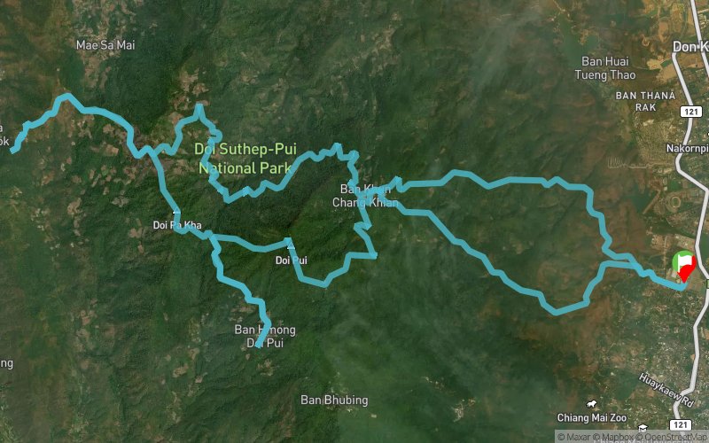
The perfect ultra introduction—respectable distance meets mountain challenge
CM3 strikes the ideal balance for runners stepping up from shorter trail races or transitioning from road marathons. After the signature 10km climb to the Hmong village HQ, the route ventures through Doi Pui Summit territory and remote Pa Nok Kok Village. Technical descents test both skills and stamina, while the overall distance provides a true ultra experience without overwhelming newcomers to the format.
En voir plus... En voir moins...

Start
Distance
0 km
Altitude
332 m
D+
0 m
D-
0 m
57.3 km
2908 m
2908 m
Finish
Distance
57.3 km
Altitude
332 m
D+
2908 m
D-
2908 m
Click on a point of interest to display it on the map
Reviews and times
Add a track
CM6 CM3

Track number : 300332
Link to track :
https://tracedetrail.fr/en/trace/300332
Log in to insert this track on your website
 Trace de Trail