
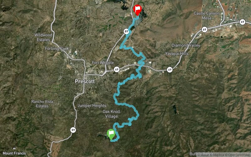
Whiskey Basin 2017 - 31 km
ITRA
 30.4 km
570 m
810 m
30.4 km
570 m
810 m

Like
Favorites
Reviews
Share
GPX
17
PDF A4
PDF A0
Profile
Flyover
3D
Insert
Passages
Prescott (US) Prescott (US)
Effort kilometer
Longest ascent
Longest descent
36
160 m
350 m
Max. elevation
Min. elevation
Quality index
2002 m
1572 m
 1pt/7m
Welcome to the 2nd annual Whiskey Basin Trail Runs! These point to point endurance foot races will take place along the Prescott Circle Trail in beautiful Prescott, Arizona. Featuring a perfect mix of high desert trails, pines and junipers this route takes you completely around the City of Prescott on some of their best trails all while never being more than a few miles from the heart of downtown and Whiskey Row. Reserve a campsite right at the 88K start/finish line for Friday and Saturday nights of the event in scenic Watson Lake Park and join us for a post race bar crawl on the infamous Whiskey Row! The 10K course will also start and finish at Watson Lake Park with an out and back section on the Peavine and Watson Lake Trails taking in some of the beautiful Granite Dells.
En voir plus... En voir moins...

Start
Distance
0 km
Altitude
1846 m
D+
0 m
D-
0 m
30.4 km
562 m
809 m
Finish
Distance
30.4 km
Altitude
1599 m
D+
562 m
D-
809 m
Click on a point of interest to display it on the map
Reviews and times
Add a track
Whiskey Basin 2017 - 31 km

Track number : 28863
Link to track :
https://tracedetrail.fr/en/trace/28863
Log in to insert this track on your website
 Trace de Trail