
 25.28 km
1221 m
1221 m
25.28 km
1221 m
1221 m


 1pt/7m
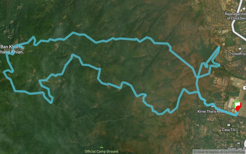
The first 5km will be a mixture of tarmac and single-track dirt trail over relatively flat and uneventful terrain. A small water station near the reservoir will be around the 4-kilometre mark. From there, the trail will relentlessly pitch upwards from 355 to 1,350 metres above mean sea level over about 7 kilometres. The average gradient is just over 14%, but some parts are much steeper and tricky to negotiate when wet. This part of the course will start as a single-track trail for around 5 kilometres, followed by a dirt road for 2.5 kilometres.
An aid station (A9) will be at the top of this climb. Snacks and beverages (and toilets) will be available here.
Exiting the A9 heading West through the village, your long descent begins. The dirt road will last roughly 8.5 kilometres, followed by a technical single-track for three more kilometres. Then it's the home stretch. A small water station for the descent will be at around 17-kilometre mark.
The trail's and the road's surface are a mix of everything you do not want your running surface to be - gravelly and rocky when dry, muddy and slippery when wet. Enticing?


 Trace de Trail