
AOB100
 109.05 km
3985 m
5101 m
109.05 km
3985 m
5101 m

23/11/2024
Like
Favorites
Reviews
Share
GPX
3
PDF A4
PDF A0
Profile
Flyover
3D
Insert
Passages
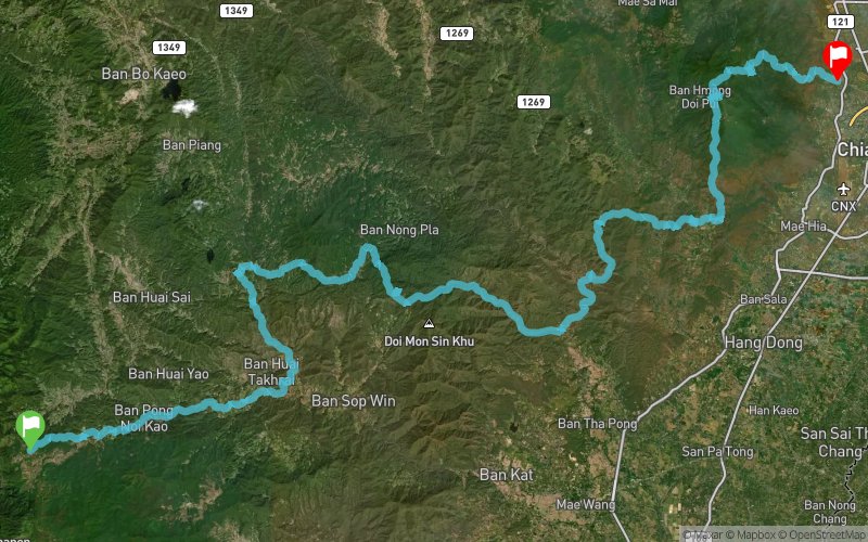
Mae Chaem (TH) Muang Chiang Mai (TH)
Effort kilometer
Longest ascent
Longest descent
148
1300 m
1370 m
Max. elevation
Min. elevation
Quality index
1601 m
327 m
 1pt/8m
The name of the game is from Doi Inthanon to Doi Pui. Highlights along the route include a long scenic descent, a beautiful temple in the middle of the forest, a ridgeline above a river gorge and a challenging final climb to the summit of Doi Pui.

Start
Distance
0 km
Altitude
1448 m
D+
0 m
D-
0 m
109.1 km
3985 m
5101 m
Finish
Distance
109.1 km
Altitude
332 m
D+
3985 m
D-
5101 m
Click on a point of interest to display it on the map
Reviews and times
Add a track
AIA One Billion Trail AOB100

Track number : 274172
Link to track :
https://tracedetrail.fr/en/trace/274172
Log in to insert this track on your website
 Trace de Trail