
Land Split
ITRA
 17.5 km
638 m
643 m
17.5 km
638 m
643 m

Like
Favorites
Reviews
Share
GPX
2
PDF A4
PDF A0
Profile
Flyover
3D
Insert
Passages
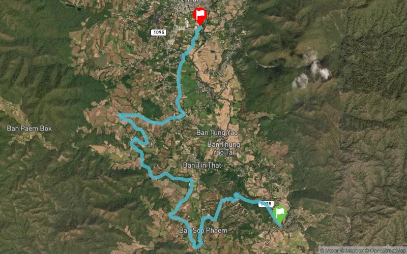
Pai (TH) Pai (TH)
Effort kilometer
Longest ascent
Longest descent
23
110 m
90 m
Max. elevation
Min. elevation
Quality index
566 m
448 m
 1pt/11m
The "Landsplit" is a quick dash (but not so short) across from the Bridge through Pai Canyon and the lush rice field of Baan Sob Pam up to the Land Split and into Pai proper!

Start
Distance
0 km
Altitude
482 m
D+
0 m
D-
0 m
17.5 km
638 m
643 m
Finish
Distance
17.5 km
Altitude
477 m
D+
638 m
D-
643 m
Click on a point of interest to display it on the map
Reviews and times
Add a track
The Westwind Trail Land Split

Track number : 267561
Link to track :
https://tracedetrail.fr/en/trace/267561
Log in to insert this track on your website
 Trace de Trail