
Sightseeing
ITRA
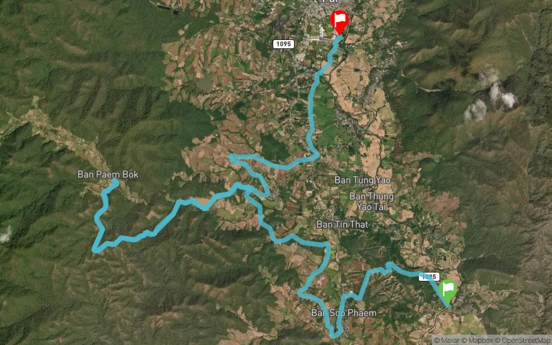
 31.45 km
1373 m
1378 m
31.45 km
1373 m
1378 m


Like
Favorites
Reviews
Share
GPX
1
PDF A4
PDF A0
Profile
Flyover
3D
Insert
Passages
Pai (TH) Pai (TH)
Effort kilometer
Longest ascent
Longest descent
45
200 m
220 m
Max. elevation
Min. elevation
Quality index
793 m
448 m
 1pt/8m
The "Sightseeing" is the fastest way to visit all the Wonders of Pai on foot. Starting from Pai Historical Bridge, you will be visiting The Pai Canyon, The Land Split, and the Bamboo Bridge in (not so) quick succession.

Start
Distance
0 km
Altitude
482 m
D+
0 m
D-
0 m
31.5 km
1373 m
1378 m
Finish
Distance
31.5 km
Altitude
477 m
D+
1373 m
D-
1378 m
Click on a point of interest to display it on the map
Reviews and times
Add a track
The Westwind Trail Sightseeing

Track number : 267560
Link to track :
https://tracedetrail.fr/en/trace/267560
Log in to insert this track on your website
 Trace de Trail