
Ridge Line
ITRA
 61.86 km
3631 m
3636 m
61.86 km
3631 m
3636 m

Like
Favorites
Reviews
Share
GPX
1
PDF A4
PDF A0
Profile
Flyover
3D
Insert
Passages
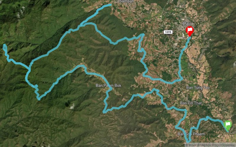
Pai (TH) Pai (TH)
Effort kilometer
Longest ascent
Longest descent
98
1180 m
990 m
Max. elevation
Min. elevation
Quality index
1836 m
448 m
 1pt/13m
Starting from Pai Historical Bridge, "Ridge Line" strings two of the most iconic climbs in Pai together. Top it off with a visit to the beautiful village of Yun Lai before tracing the steps back up a few kilometres before heading back into Pai.

Start
Distance
0 km
Altitude
482 m
D+
0 m
D-
0 m
61.9 km
3631 m
3636 m
Finish
Distance
61.9 km
Altitude
477 m
D+
3631 m
D-
3636 m
Click on a point of interest to display it on the map
Reviews and times
Add a track
The Westwind Trail Ridge Line

Track number : 267559
Link to track :
https://tracedetrail.fr/en/trace/267559
Log in to insert this track on your website
 Trace de Trail