
 99.92 km
6115 m
6115 m
99.92 km
6115 m
6115 m
 1pt/8m
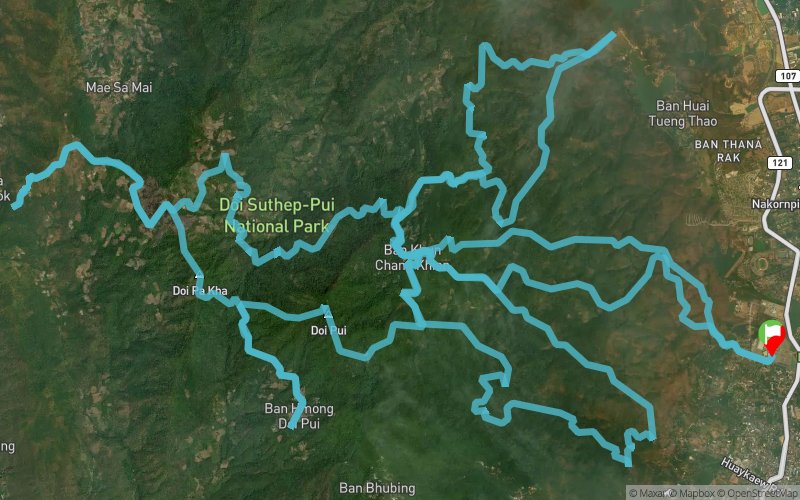
CM5 is to CM6, not as Robin is to Batman. As with every CM distance, the first hurdle is a 10km hike to the Hmong village (the HQ), situated at around 1400m above mean sea level.
Leaving the HQ for the first time, you will be heading N/NE to Huay Tung Tao Reservoir. Several sections are steep but not very technical.
Second time out from the HQ, using the steep trail to go up near the Doi Pui summit (1600+m above mean sea level), you will be making a long circular route heading to Pa Nok Kok Village and back to the HQ again.
Relatively short, and the last loop is to Monthatarn Waterfall. Situated at around 15 minutes drive from the City, this aid station is convenient for your support to meet and make sure you carry on with the race!
One last climb from to the HQ, and it will be downhill from there - literally.


 Trace de Trail