
Laugavegur Ultra marathon
 53.2 km
1592 m
1977 m
53.2 km
1592 m
1977 m
16/07/2016
Like
Favorites
Reviews
Share
GPX
10
PDF A4
PDF A0
Profile
Flyover
3D
Insert
Passages
Inconnu (ND) Inconnu (ND)
Effort kilometer
Longest ascent
Longest descent
69
210 m
1590 m
Max. elevation
Min. elevation
Quality index
1039 m
190 m
 1pt/7m
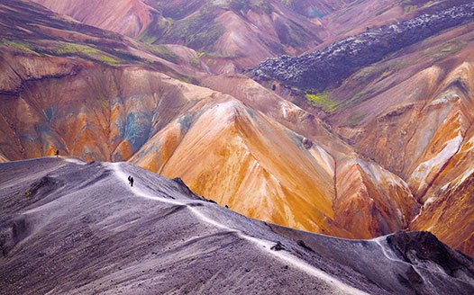
Laugavegur is located in the southern highlands of Iceland and connects the nature reserves Landmannalaugar and Thorsmork. Due to its location, Laugavegur is serviced for only a few weeks a year.
For many runners the Laugavegur Ultra Marathon is the most enjoyable race in Iceland. The course takes runners through areas of outstanding natural beauty at the same time as being a challenging course. Hikers normally cover this distance in four days. The course is multi-terrain; sand, gravel, grass, snow, ice, rivers and streams.
En voir plus... En voir moins...


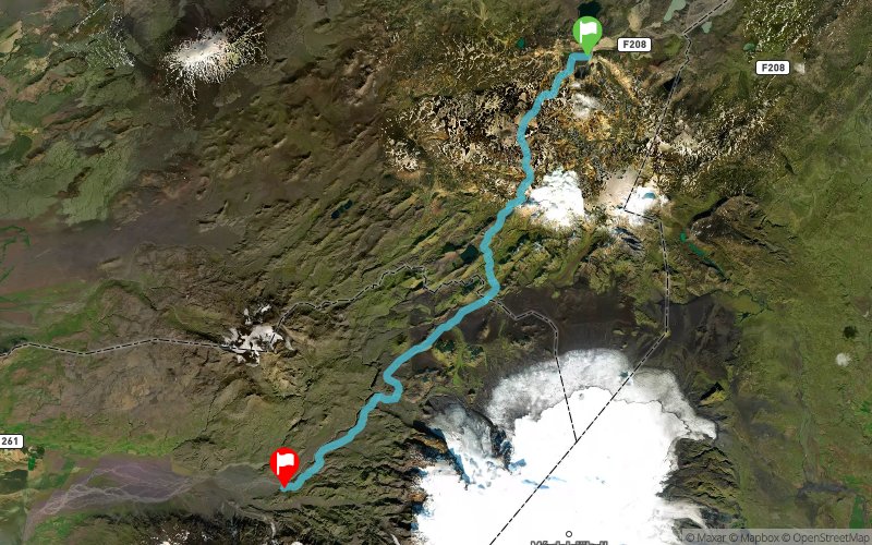
Start
Distance
0 km
Altitude
581 m
D+
0 m
D-
0 m
10 km
635 m
208 m
Hrafntinnusker - Summit
Distance
10 km
Altitude
1012 m
D+
635 m
D-
208 m
11.2 km
199 m
670 m
Álftavatn - Lake
Distance
21.2 km
Altitude
535 m
D+
834 m
D-
878 m
16.2 km
380 m
464 m
Emstrur - Hut
Distance
37.4 km
Altitude
455 m
D+
1214 m
D-
1342 m
15.8 km
378 m
635 m
Finish
Distance
53.2 km
Altitude
198 m
D+
1592 m
D-
1977 m
Click on a point of interest to display it on the map
Reviews and times
Add a track
Laugavegur Ultra marathon

Track number : 25051
Link to track :
https://tracedetrail.fr/en/trace/25051
Log in to insert this track on your website
 Trace de Trail