
17km
ITRA
 17 km
1350 m
1350 m
17 km
1350 m
1350 m

GPX
1
PDF
Profile
Share
3D
Favorites
Reviews
Like
Glavaš/Kijevo (HR) Glavaš/Kijevo (HR)
Effort kilometer
Longest ascent
Longest descent
30
1310 m
1270 m
Max. elevation
Min. elevation
Quality index
1794 m
545 m
 1pt/29m
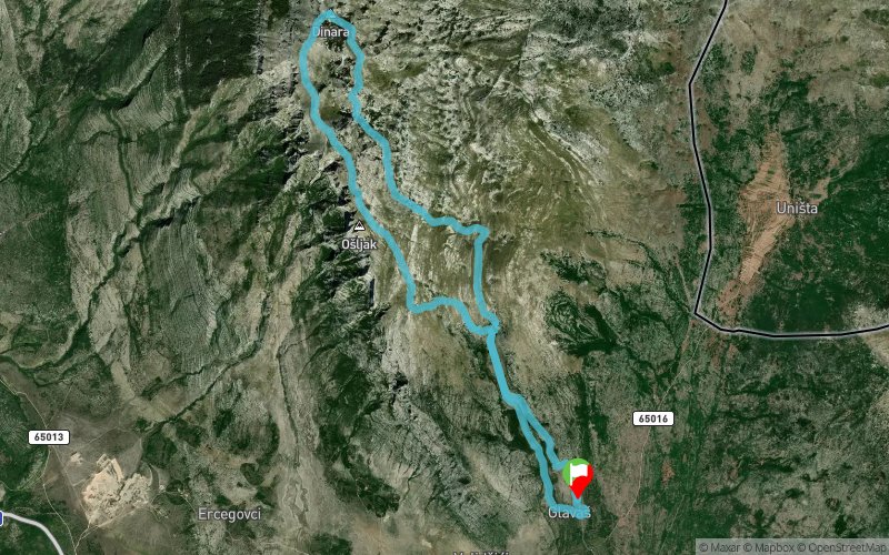
The trail race on the highest peak of Croatia. The track is 100% single trail, steep and very tehnical. Start and the finish is from the mountain hut Glavaš.

Start
Distance
0 km
Altitude
566 m
D+
0 m
D-
0 m
17 km
1350 m
1350 m
Finish
Distance
17 km
Altitude
566 m
D+
1350 m
D-
1350 m
Click on a point of interest to display it on the map
Reviews and times
Add a track
Sinjal - Utrka na Vrh Hrvatske 17km

Track number : 246415
Link to track :
https://tracedetrail.fr/en/trace/246415
Log in to insert this track on your website
 Trace de Trail