
Grand Canyon 2016 - 50 K
ITRA
 53.2 km
1050 m
1030 m
53.2 km
1050 m
1030 m

Like
Favorites
Reviews
Share
GPX
11
PDF A4
PDF A0
Profile
Flyover
3D
Insert
Passages
Inconnu (US) Inconnu (US)
Effort kilometer
Longest ascent
Longest descent
63
150 m
320 m
Max. elevation
Min. elevation
Quality index
2486 m
2143 m
 1pt/9m
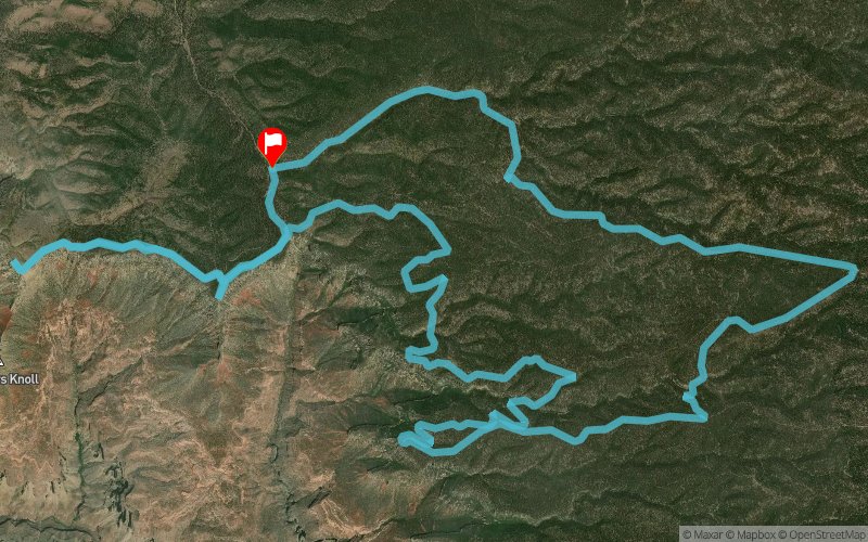
The 50K route is a point-to-point race starting with an early morning shuttle (4:45am) out to Fence Point for a 6am start on Saturday where you will see an unforgettable sunrise, then connects into the Rainbow Rim trail for 19 miles with 5 overlook points along the way, then does an out and back to Stina Point and then climbs up the plateau to finish at an elevation of just over 9,000ft.
En voir plus... En voir moins...

Start
Distance
0 km
Altitude
2143 m
D+
0 m
D-
0 m
53.2 km
1049 m
1026 m
Finish
Distance
53.2 km
Altitude
2159 m
D+
1049 m
D-
1026 m
Click on a point of interest to display it on the map
Reviews and times
Add a track
Grand Canyon 2016 - 50 K

Track number : 17020
Link to track :
https://tracedetrail.fr/en/trace/17020
Log in to insert this track on your website
 Trace de Trail