
Wibolt 2015
ITRA
 321.7 km
12540 m
12560 m
321.7 km
12540 m
12560 m

Like
Favorites
Reviews
Share
GPX
9
PDF A4
PDF A0
Profile
Flyover
3D
Insert
Passages
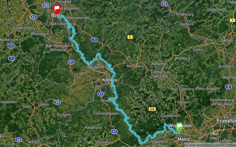
Wiesbaden (DE) Bonn (DE)
Effort kilometer
Longest ascent
Longest descent
447
250 m
310 m
Max. elevation
Min. elevation
Quality index
362 m
46 m
 1pt/10m
320km at the Rheinsteig in Germany. A long trail from Wiesbaden until Bonn. 12 refreshments points and 3 sleeping station. This is the 4th time for WiBoLT. More and more people from other nations run this distance between 48h until 90 h.

Start
Distance
0 km
Altitude
83 m
D+
0 m
D-
0 m
321.7 km
12532 m
12559 m
Finish
Distance
321.7 km
Altitude
57 m
D+
12532 m
D-
12559 m
Click on a point of interest to display it on the map
Reviews and times
Add a track
Wibolt 2015

Track number : 13773
Link to track :
https://tracedetrail.fr/en/trace/13773
Log in to insert this track on your website
 Trace de Trail