
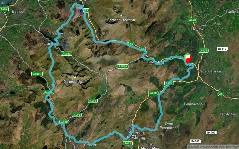
The Ultra Tour of Snowdonia 2015 - Snowdonia 50
ITRA
 94.5 km
2780 m
2780 m
94.5 km
2780 m
2780 m

Like
Favorites
Reviews
Share
GPX
9
PDF A4
PDF A0
Profile
Flyover
3D
Insert
Passages
Betws-y-Coed Community (GB) Inconnu (GB)
Effort kilometer
Longest ascent
Longest descent
122
270 m
400 m
Max. elevation
Min. elevation
Quality index
527 m
10 m
 1pt/6m
The Eryri 50/Snowdonia 50 is a 58 mile footrace, the essence of which is to offer competitors an experience deep in the countryside, making use of the well-trodden paths of Snowdonia. Competitors run at one’s own speed, but within a time limit.

Start
Distance
0 km
Altitude
38 m
D+
0 m
D-
0 m
94.5 km
2780 m
2780 m
Finish
Distance
94.5 km
Altitude
38 m
D+
2780 m
D-
2780 m
Click on a point of interest to display it on the map
Reviews and times
Add a track
The Ultra Tour of Snowdonia 2015 - Snowdonia 50

Track number : 13582
Link to track :
https://tracedetrail.fr/en/trace/13582
Log in to insert this track on your website
 Trace de Trail