
Malnad Ultra 2019 - 110K
ITRA
 113.2 km
3620 m
3620 m
113.2 km
3620 m
3620 m

02/11/2019
Like
Favorites
Reviews
Share
GPX
PDF A4
PDF A0
Profile
Flyover
3D
Insert
Passages
Mugthihalli (IN) Mugthihalli (IN)
Effort kilometer
Longest ascent
Longest descent
149
380 m
300 m
Max. elevation
Min. elevation
Quality index
1271 m
802 m
 1pt/11m
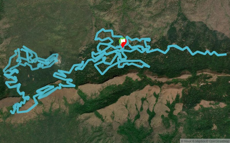
New Malnad Ultra 110K Route with start and finish in Maskalmardi and passing through Kerekhan and SVT Estates

Start/Finish 110K
Distance
0 km
Altitude
1031 m
D+
0 m
D-
0 m
113.2 km
3620 m
3620 m
Finish
Distance
113.2 km
Altitude
1031 m
D+
3620 m
D-
3620 m
Click on a point of interest to display it on the map
Reviews and times
Warning ! This track is only accessible on the day of the competition
Add a track
Malnad Ultra 2019 - 110K

Track number : 100463
Link to track :
https://tracedetrail.fr/en/trace/100463
Log in to insert this track on your website
 Trace de Trail