Afficher la carte
PARCOURS OFFICIEL
Vuokatti Trail Challenge 2015 - 23km


 Laakajärvi (FI)
 Maanselkä (FI)


23 km
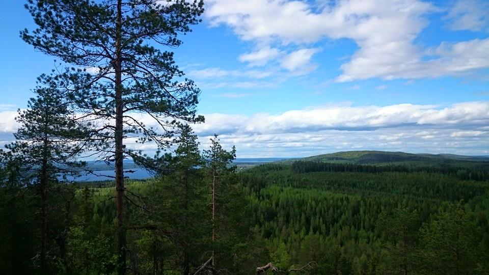
The start is located at an old school in Teerivaara and the finish is at hotel Vuokatinhovi. The track follows UKK- hiking route and goes over total of 13 large hills or ‘vaara’ as called in Finnish. The track offers outstanding hill, forest and lake sights for runners. The route is same as in 13 Vaaran Maastomaraton held in previous years and the traditional Vuokatin Vaellus. Total height difference is about 900 meters and some of the climbs and descends are very steep and rocky, which makes the run very technical and challenging. Runners should be careful on the hill sides especially in wet conditions. As the route is very demanding especially in the last 12 kilometers it is sure to offer unforgettable experiences when overcoming the challenges. However, the hard work is rewarded with superb sights at the top of the numerous hills. The track is very versatile. It’s mostly wide and clean path but there’s also duckboards and stairs, rocks and rocky areas as well as short parts of sand roads. Despite the very technical parts, the track is generally well runnable. This route is by far the most stunning and awe-inspiring part of the Vuokatti Trail Challenge.
Table des passages
| Cumul | Intermédiaire | |||||||
|---|---|---|---|---|---|---|---|---|
| Passage | Description | Alt. | Dist. | D+ | D- | Dist. | D+ | D- |
 Compétition organisée le 27/06/2015
Trace n°8825
Seuil de dénivelé : 3 m Seuil de distance : 30 m Lissage : Oui Origine des altitudes : MNT Aster GDEM
Seuil de dénivelé : 3 m Seuil de distance : 30 m Lissage : Oui Origine des altitudes : MNT Aster GDEM
Traversée
Terrain dominant : Sentier
Alti. max. : 388 m
Alti. moyenne : 235 m
Alti. min. : 122 m
+ longue montée : 160 m
+ longue descente : 170 m
Terrain dominant : Sentier
Alti. max. : 388 m
Alti. moyenne : 235 m
Alti. min. : 122 m
+ longue montée : 160 m
+ longue descente : 170 m
Profils altimétriques
Plus d'outils
Créer une page de roadbook
Carte et profil sur votre site web
Attention ! En insérant une carte Trace de Trail sur votre site web, vous vous engagez à ne masquer aucun élément du module (liens vers Trace de Trail ou bannière Trail Connect), que ce soit en utilisant l'iframe ou le widget.
Ajouter une réalisation
Valider
Ajoutez une réalisation pour partager votre chrono et détailler les conditions que vous avez recontrées lors de votre sortie trail !
Ajouter un commentaire
Valider
Afficher les infos
Ajouter une trace


