Afficher la carte
PARCOURS OFFICIEL
Vuokatti Trail Challenge 2017 - 42 km


 Laakajärvi (FI)
 Pohjavaara (FI)


42 km
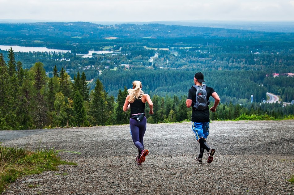
The start of the Vuokatti Trail Challenge 42 km competition is located at the Maanselän Etappi and the finish is at the hotel Vuokatinhovi. The track follows UKK-hiking path and offers great scenery and beautiful wilderness with old boreal forests. Shortly after the Maanselän Etappi there is a long uphill as the track goes over Lappavaara hill area. After that the track is rather even and there are no big climbs before Teerivaara. The condition of the UKK-hiking path gets better in this part of the track and the duckboards and bridges are generally in good condition. The path is also good and easy to run. Wildlife can be seen throughout the Vuokatti Trail Challenge track for example grouse birds like black grouse and capercaillie. After Teerivaara the competition route is the same as the 23 km route (see 23 km route description) and it will lead the runners towards the legendary 13 Hill´s area called Vuokatinvaara which is the great and very hard ending to 42 km track. Sceneries are amazing in this Vuokatinvaara area which will start about 23km before finish.
Table des passages
| Cumul | Intermédiaire | |||||||
|---|---|---|---|---|---|---|---|---|
| Passage | Description | Alt. | Dist. | D+ | D- | Dist. | D+ | D- |
 Compétition organisée le 02/09/2017
Trace n°29236
Seuil de dénivelé : 3 m Seuil de distance : 0 m Lissage : Non Origine des altitudes : GPS
Seuil de dénivelé : 3 m Seuil de distance : 0 m Lissage : Non Origine des altitudes : GPS
Traversée
Terrain dominant : Sentier
Alti. max. : 372 m
Alti. moyenne : 261 m
Alti. min. : 161 m
+ longue montée : 160 m
+ longue descente : 180 m
Terrain dominant : Sentier
Alti. max. : 372 m
Alti. moyenne : 261 m
Alti. min. : 161 m
+ longue montée : 160 m
+ longue descente : 180 m
Profils altimétriques
Plus d'outils
Créer une page de roadbook
Carte et profil sur votre site web
Attention ! En insérant une carte Trace de Trail sur votre site web, vous vous engagez à ne masquer aucun élément du module (liens vers Trace de Trail ou bannière Trail Connect), que ce soit en utilisant l'iframe ou le widget.
Ajouter une réalisation
Valider
Ajoutez une réalisation pour partager votre chrono et détailler les conditions que vous avez recontrées lors de votre sortie trail !
Ajouter un commentaire
Valider
Afficher les infos
Ajouter une trace


