Show the map
OFFICIAL ROUTE
Nendaz trail 70km


 Haute-Nendaz (CH)
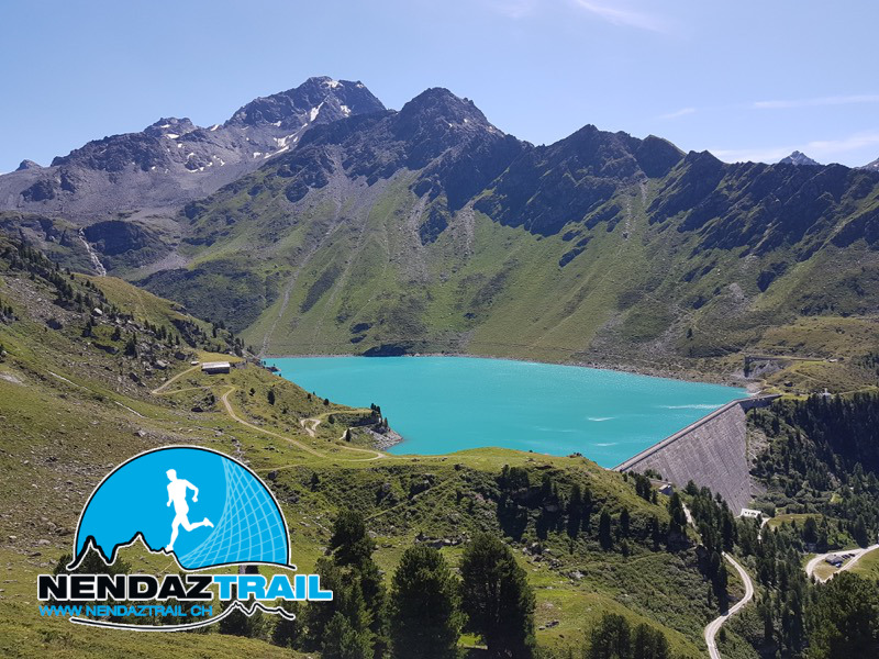
This extremely varied and demanding trail brings you through forests, mountain pastures, rock fields and along alpine footpaths. With its positive as well as negative variation in altitude of over 3'500 m for a total distance of 70 km, this itinerary is reserved for the more advanced trail runner. Your efforts are rewarded by the breathtaking landscapes like the Crêtes de Thyon (mountain ridges), the Grand Désert lake without mentioning the Pra Fleuri pass located at 2987 m in altitude.
Points of Interest table
| Accum. | Intermediary | |||||||
|---|---|---|---|---|---|---|---|---|
| POI | Description | Alt. | Dist. | D+ | D- | Dist. | D+ | D- |
Trace n°99761
Ascent threshold : 3 m Distance threshold : 30 m Smoothing : Yes Origin of altitudes : MNT Google
Ascent threshold : 3 m Distance threshold : 30 m Smoothing : Yes Origin of altitudes : MNT Google
Loop
Dominant terrain : Footpath
Max alti. : 2983 m
Avg alti. : 2122 m
Min alti. : 1343 m
Longest ascent : 1650 m
Longest descent : 1040 m
Route completed by the author : No
Dominant terrain : Footpath
Max alti. : 2983 m
Avg alti. : 2122 m
Min alti. : 1343 m
Longest ascent : 1650 m
Longest descent : 1040 m
Route completed by the author : No
Elevation profile
More tools
Create a new roadbook page
Map and track on your website
Warning ! When you insert a Trace de Trail map on your website, you agree not to hide any element of the module (links to Trail Trail or Trail Connect banner)
Add a realisation
Validate
Add a realisation to share your chrono and describe the conditions that you encountered during you trail running !
Add a comment
Validate
Show the infos
Le parcours est fermé jusqu'à la fin de l'hiver.
Add a track


