Show the map
Certified Track - ITRA
GGUT 110 I 2 Part 2


60.5 km
3780 m
4380 m
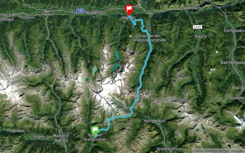
 Ködnitz (AT)
 Kaprun (AT)
 8
8 Points of Interest table
| Accum. | Intermediary | |||||||
|---|---|---|---|---|---|---|---|---|
| POI | Description | Alt. | Dist. | D+ | D- | Dist. | D+ | D- |
 Competition organized on 07/25/2020
Trace n°99457
Ascent threshold : 3 m Distance threshold : 0 m Smoothing : No Origin of altitudes : GPS
Ascent threshold : 3 m Distance threshold : 0 m Smoothing : No Origin of altitudes : GPS
Crossing
Dominant terrain : Footpath
Max alti. : 2811 m
Avg alti. : 1753 m
Min alti. : 769 m
Longest ascent : 890 m
Longest descent : 1990 m
Dominant terrain : Footpath
Max alti. : 2811 m
Avg alti. : 1753 m
Min alti. : 769 m
Longest ascent : 890 m
Longest descent : 1990 m
Elevation profile
More tools
Create a new roadbook page
Map and track on your website
Warning ! When you insert a Trace de Trail map on your website, you agree not to hide any element of the module (links to Trail Trail or Trail Connect banner)
Add a realisation
Validate
Add a realisation to share your chrono and describe the conditions that you encountered during you trail running !
Add a comment
Validate
Show the infos
Add a track


