Show the map
Evaluated Track - ITRA
Ultra-Trail du Haut-Giffre 2020 - La Montée à Gers
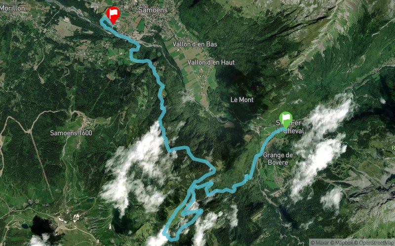


17.8 km
970 m
1040 m
 Sixt-Fer-à-Cheval (74)
 Samoëns (74)
 7
7 240
240 Points of Interest table
| Accum. | Intermediary | |||||||
|---|---|---|---|---|---|---|---|---|
| POI | Description | Alt. | Dist. | D+ | D- | Dist. | D+ | D- |
 Competition organized on 06/21/2020
Trace n°93477
Ascent threshold : 3 m Distance threshold : 30 m Smoothing : Yes Origin of altitudes : MNT IGN
Ascent threshold : 3 m Distance threshold : 30 m Smoothing : Yes Origin of altitudes : MNT IGN
Crossing
Dominant terrain : Footpath
Max alti. : 1654 m
Avg alti. : 1192 m
Min alti. : 685 m
Longest ascent : 920 m
Longest descent : 1020 m
Dominant terrain : Footpath
Max alti. : 1654 m
Avg alti. : 1192 m
Min alti. : 685 m
Longest ascent : 920 m
Longest descent : 1020 m
Elevation profile
More tools
Create a new roadbook page
Map and track on your website
Warning ! When you insert a Trace de Trail map on your website, you agree not to hide any element of the module (links to Trail Trail or Trail Connect banner)
Add a realisation
Validate
Add a realisation to share your chrono and describe the conditions that you encountered during you trail running !
Add a comment
Validate
Show the infos
Add a track


