Route 4 - L'Etang de la Vergne
Add to my favorites

Route opened
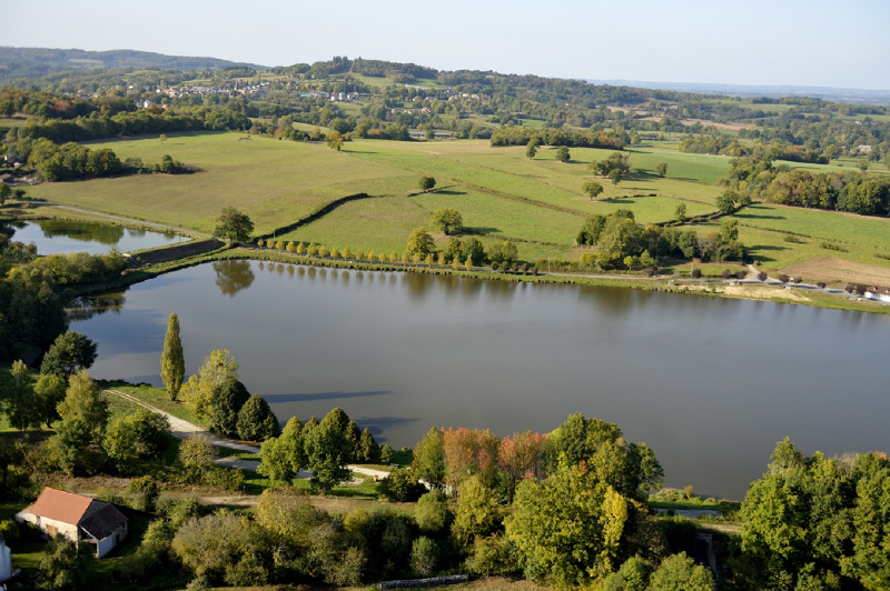
A discovery of the hollow paths of the town before returning by the Vergne's pond.
The characteristics of the route.
Bussière-Dunoise (23)
- Distance 11.9 km
- Elevation gain 160 m
- Elevation lost 160 m
- Min. elevation 352 m
- Max. elevation. 450 m
- Duration (depending on pace) 3h
- Marking yellow
Add your time and share your feelings


Follow us on
the digital trails
the digital trails


![]()
Info & contacts :
Communauté d'Agglomération du Grand Guéret
Service Sports de nature
Tel : +33(0)5 55 41 04 48
contact@sportsnature-montsdegueret.com


OK
Annuler