Show the map
Grand Raid Queyras 58km 2013
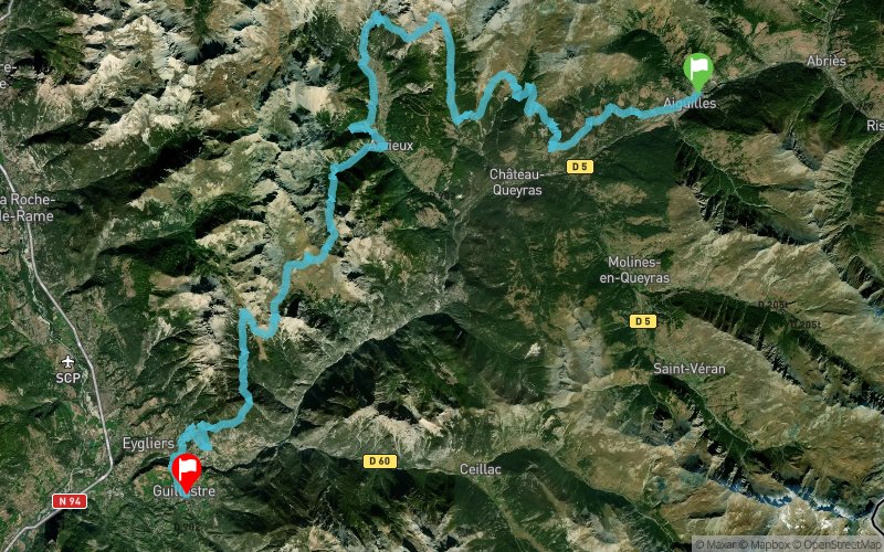


 Aiguilles (05)
 Guillestre (05)
 Points of Interest table
| Accum. | Intermediary | |||||||
|---|---|---|---|---|---|---|---|---|
| POI | Description | Alt. | Dist. | D+ | D- | Dist. | D+ | D- |
 Competition organized on 06/29/2013
Trace n°903
Ascent threshold : 0 m Distance threshold : 35 m Smoothing : Yes Origin of altitudes : MNT Aster GDEM
Ascent threshold : 0 m Distance threshold : 35 m Smoothing : Yes Origin of altitudes : MNT Aster GDEM
Crossing
Dominant terrain : Footpath
Max alti. : 2491 m
Avg alti. : 1888 m
Min alti. : 921 m
Longest ascent : 969 m
Longest descent : 1105 m
Dominant terrain : Footpath
Max alti. : 2491 m
Avg alti. : 1888 m
Min alti. : 921 m
Longest ascent : 969 m
Longest descent : 1105 m
Elevation profile
More tools
Create a new roadbook page
Map and track on your website
Warning ! When you insert a Trace de Trail map on your website, you agree not to hide any element of the module (links to Trail Trail or Trail Connect banner)
Add a realisation
Validate
Add a realisation to share your chrono and describe the conditions that you encountered during you trail running !
Add a comment
Validate
Admin - Trace de Trail
22/07/13, 07:07:25
Super ! Merci pour la trace et la réalisation détaillée, on s'y croirait !
22/07/13, 07:07:25
Super ! Merci pour la trace et la réalisation détaillée, on s'y croirait !
Show the infos
Add a track


