Show the map
Trail de Quaix 2019 - Marche
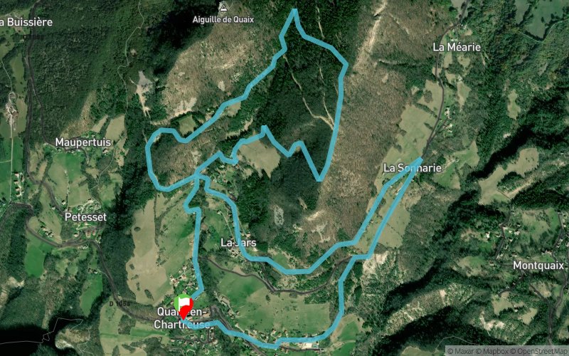


8.4 km
600 m
600 m
 Quaix-en-Chartreuse (38)
 Points of Interest table
| Accum. | Intermediary | |||||||
|---|---|---|---|---|---|---|---|---|
| POI | Description | Alt. | Dist. | D+ | D- | Dist. | D+ | D- |
 Event off organized on 05/19/2019
Trace n°86369
Ascent threshold : 3 m Distance threshold : 30 m Smoothing : Yes Origin of altitudes : MNT Aster GDEM
Ascent threshold : 3 m Distance threshold : 30 m Smoothing : Yes Origin of altitudes : MNT Aster GDEM
Loop
Dominant terrain : Footpath
Max alti. : 1012 m
Avg alti. : 709 m
Min alti. : 502 m
Longest ascent : 480 m
Longest descent : 410 m
Dominant terrain : Footpath
Max alti. : 1012 m
Avg alti. : 709 m
Min alti. : 502 m
Longest ascent : 480 m
Longest descent : 410 m
Elevation profile
More tools
Create a new roadbook page
Map and track on your website
Warning ! When you insert a Trace de Trail map on your website, you agree not to hide any element of the module (links to Trail Trail or Trail Connect banner)
Add a realisation
Validate
Add a realisation to share your chrono and describe the conditions that you encountered during you trail running !
Add a comment
Validate
Admin - Trace de Trail
09/05/19, 22:13:13
Bonjour, Merci de renommer votre trace avant de la placer en public.
09/05/19, 22:13:13
Bonjour, Merci de renommer votre trace avant de la placer en public.
Show the infos
Add a track


