Show the map
Certified Track - ITRA
new 20k route
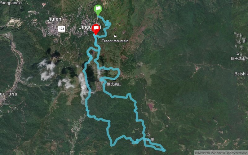


22 km
1640 m
1640 m
 Unknown (ND)
 Unknown (ND)
 8
8 200
200 Points of Interest table
| Accum. | Intermediary | |||||||
|---|---|---|---|---|---|---|---|---|
| POI | Description | Alt. | Dist. | D+ | D- | Dist. | D+ | D- |
 Competition organized on 04/21/2019
Trace n°85738
Ascent threshold : 3 m Distance threshold : 30 m Smoothing : Yes Origin of altitudes : MNT Aster GDEM
Ascent threshold : 3 m Distance threshold : 30 m Smoothing : Yes Origin of altitudes : MNT Aster GDEM
Loop
Dominant terrain : Path
Max alti. : 697 m
Avg alti. : 430 m
Min alti. : 205 m
Longest ascent : 460 m
Longest descent : 340 m
Dominant terrain : Path
Max alti. : 697 m
Avg alti. : 430 m
Min alti. : 205 m
Longest ascent : 460 m
Longest descent : 340 m
Elevation profile
More tools
Create a new roadbook page
Map and track on your website
Warning ! When you insert a Trace de Trail map on your website, you agree not to hide any element of the module (links to Trail Trail or Trail Connect banner)
Add a realisation
Validate
Add a realisation to share your chrono and describe the conditions that you encountered during you trail running !
Add a comment
Validate
Admin - Trace de Trail
04/05/19, 07:04:11
Bonjour, Merci de renommer votre trace de manière à ce que la compétition puisse facilement être identifiée.
04/05/19, 07:04:11
Bonjour, Merci de renommer votre trace de manière à ce que la compétition puisse facilement être identifiée.
Show the infos
Add a track


