Show the map
ETAPA 1 72GP VILA-REAL - MORELLA
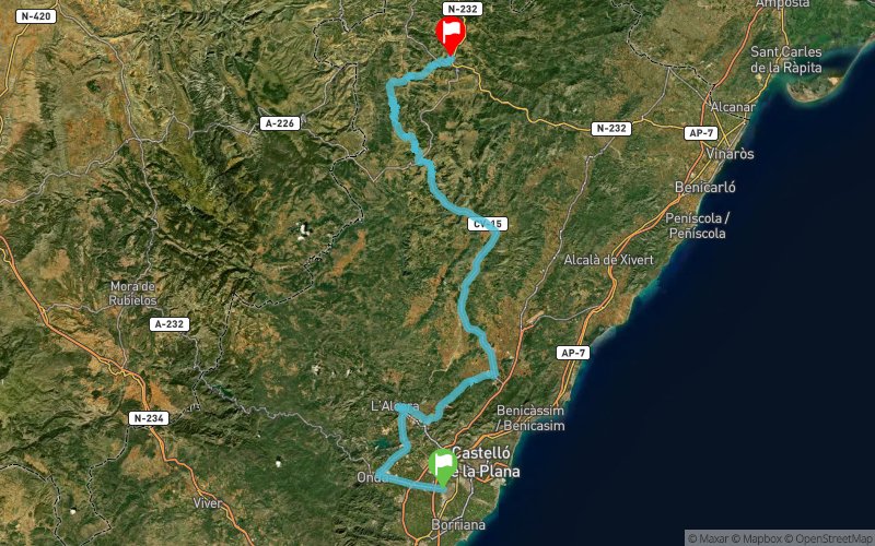


 Vila-Real/Villarreal (ES)
 Morella (ES)
 Points of Interest table
| Accum. | Intermediary | |||||||
|---|---|---|---|---|---|---|---|---|
| POI | Description | Alt. | Dist. | D+ | D- | Dist. | D+ | D- |
Trace n°84992
Ascent threshold : 3 m Distance threshold : 30 m Smoothing : No Origin of altitudes : MNT Aster GDEM
Ascent threshold : 3 m Distance threshold : 30 m Smoothing : No Origin of altitudes : MNT Aster GDEM
Crossing
Dominant terrain : Road
Max alti. : 1280 m
Avg alti. : 549 m
Min alti. : 42 m
Longest ascent : 670 m
Longest descent : 500 m
Route completed by the author : Yes
Dominant terrain : Road
Max alti. : 1280 m
Avg alti. : 549 m
Min alti. : 42 m
Longest ascent : 670 m
Longest descent : 500 m
Route completed by the author : Yes
Elevation profile
More tools
Create a new roadbook page
Map and track on your website
Warning ! When you insert a Trace de Trail map on your website, you agree not to hide any element of the module (links to Trail Trail or Trail Connect banner)
Add a realisation
Validate
Add a realisation to share your chrono and describe the conditions that you encountered during you trail running !
Add a comment
Validate
Admin - Trace de Trail
29/04/19, 22:07:43
Bonjour, Merci de classer votre trace en compétition avant de la placer en public.
29/04/19, 22:07:43
Bonjour, Merci de classer votre trace en compétition avant de la placer en public.
Admin - Trace de Trail
25/04/19, 22:59:30
Bonjour, merci de respecter les règles de nommage du site avant de placer votre trace en public : https://tracedetrail.fr/fr/accueil/help/alire
25/04/19, 22:59:30
Bonjour, merci de respecter les règles de nommage du site avant de placer votre trace en public : https://tracedetrail.fr/fr/accueil/help/alire
Show the infos
Add a track


