Show the map
La Fourche - Maurissure
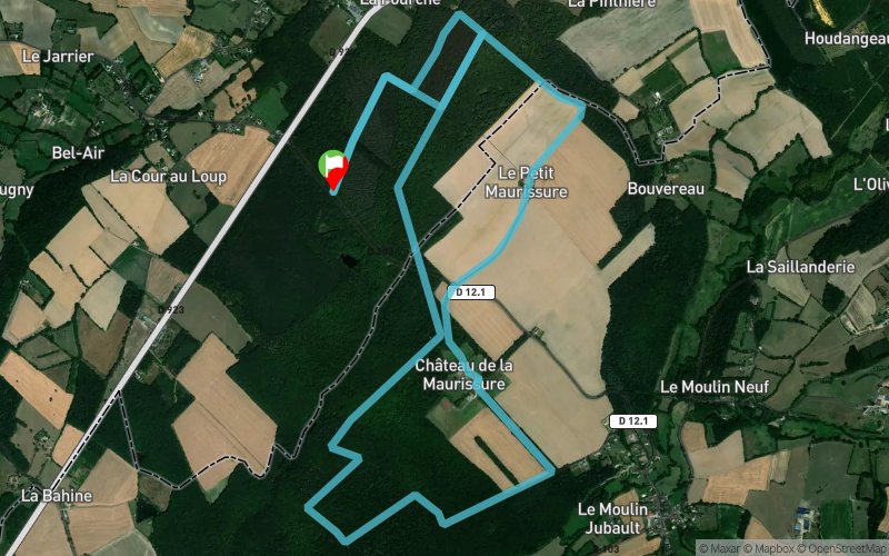


10.4 km
370 m
370 m
 Condé-sur-Huisne (61)
 Points of Interest table
| Accum. | Intermediary | |||||||
|---|---|---|---|---|---|---|---|---|
| POI | Description | Alt. | Dist. | D+ | D- | Dist. | D+ | D- |
Trace n°84676
Ascent threshold : 3 m Distance threshold : 30 m Smoothing : Yes Origin of altitudes : MNT Aster GDEM
Ascent threshold : 3 m Distance threshold : 30 m Smoothing : Yes Origin of altitudes : MNT Aster GDEM
Loop
Dominant terrain : Footpath
Max alti. : 261 m
Avg alti. : 212 m
Min alti. : 148 m
Longest ascent : 110 m
Longest descent : 60 m
Route completed by the author : No
Dominant terrain : Footpath
Max alti. : 261 m
Avg alti. : 212 m
Min alti. : 148 m
Longest ascent : 110 m
Longest descent : 60 m
Route completed by the author : No
Elevation profile
More tools
Create a new roadbook page
Map and track on your website
Warning ! When you insert a Trace de Trail map on your website, you agree not to hide any element of the module (links to Trail Trail or Trail Connect banner)
Add a realisation
Validate
Add a realisation to share your chrono and describe the conditions that you encountered during you trail running !
Add a comment
Validate
6ril28
11/08/19, 12:21:25
Parcours difficile à suivre car de nombreuses propriétés privées doivent être franchies ce qui rend le parcours, tel qu'il est tracé, quasi impossible à suivre (barrières, clôtures,...)
11/08/19, 12:21:25
Parcours difficile à suivre car de nombreuses propriétés privées doivent être franchies ce qui rend le parcours, tel qu'il est tracé, quasi impossible à suivre (barrières, clôtures,...)
Show the infos
Add a track


