Show the map
St-Antonin - Portage
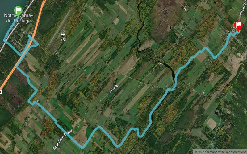


24 km
640 m
510 m
 Bas-St-Laurent-Ouest (Trois-Pistoles) (CA)
 Bas-St-Laurent-Ouest (Trois-Pistoles) (CA)
 Points of Interest table
| Accum. | Intermediary | |||||||
|---|---|---|---|---|---|---|---|---|
| POI | Description | Alt. | Dist. | D+ | D- | Dist. | D+ | D- |
Trace n°84581
Ascent threshold : 3 m Distance threshold : 30 m Smoothing : No Origin of altitudes : MNT Aster GDEM
Ascent threshold : 3 m Distance threshold : 30 m Smoothing : No Origin of altitudes : MNT Aster GDEM
Crossing
Dominant terrain : Path
Max alti. : 178 m
Avg alti. : 116 m
Min alti. : 8 m
Longest ascent : 130 m
Longest descent : 60 m
Route completed by the author : Yes
Dominant terrain : Path
Max alti. : 178 m
Avg alti. : 116 m
Min alti. : 8 m
Longest ascent : 130 m
Longest descent : 60 m
Route completed by the author : Yes
Elevation profile
More tools
Create a new roadbook page
Map and track on your website
Warning ! When you insert a Trace de Trail map on your website, you agree not to hide any element of the module (links to Trail Trail or Trail Connect banner)
Add a realisation
Validate
Add a realisation to share your chrono and describe the conditions that you encountered during you trail running !
Add a comment
Validate
snoroqc
22/04/19, 20:05:13
Bonjour trace de Trail, je crois que cela est conforme. Merci, Superbe site.
22/04/19, 20:05:13
Bonjour trace de Trail, je crois que cela est conforme. Merci, Superbe site.
Admin - Trace de Trail
18/04/19, 22:22:35
Bonjour, Merci de respecter les règles de nommage du site avant de placer votre trace en public : https://tracedetrail.com/fr/accueil/help/alire
18/04/19, 22:22:35
Bonjour, Merci de respecter les règles de nommage du site avant de placer votre trace en public : https://tracedetrail.com/fr/accueil/help/alire
Show the infos
Add a track


