Show the map
Trail de Fontainebleau Off 2019 - 45 km
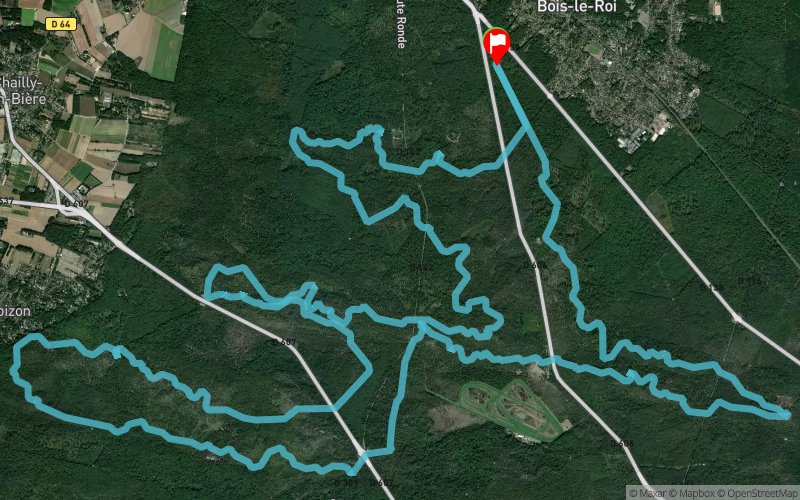


44 km
850 m
850 m
 Bois-le-Roi (77)
 Bois-le-Roi (77)
 Points of Interest table
| Accum. | Intermediary | |||||||
|---|---|---|---|---|---|---|---|---|
| POI | Description | Alt. | Dist. | D+ | D- | Dist. | D+ | D- |
 Event off organized on 04/06/2019
Trace n°83705
Ascent threshold : 0 m Distance threshold : 30 m Smoothing : Yes Origin of altitudes : MNT IGN
Ascent threshold : 0 m Distance threshold : 30 m Smoothing : Yes Origin of altitudes : MNT IGN
Loop
Dominant terrain : Footpath
Max alti. : 139 m
Avg alti. : 110 m
Min alti. : 81 m
Longest ascent : 100 m
Longest descent : 60 m
Dominant terrain : Footpath
Max alti. : 139 m
Avg alti. : 110 m
Min alti. : 81 m
Longest ascent : 100 m
Longest descent : 60 m
Elevation profile
More tools
Create a new roadbook page
Map and track on your website
Warning ! When you insert a Trace de Trail map on your website, you agree not to hide any element of the module (links to Trail Trail or Trail Connect banner)
Add a realisation
Validate
Add a realisation to share your chrono and describe the conditions that you encountered during you trail running !
Add a comment
Validate
Admin - Trace de Trail
07/04/19, 08:30:05
Bonjour, En France, et en particulier en forêt de Fontainebleau, le MNT IGN donne de bien meilleurs résultats pour le calcul du dénivelé.
07/04/19, 08:30:05
Bonjour, En France, et en particulier en forêt de Fontainebleau, le MNT IGN donne de bien meilleurs résultats pour le calcul du dénivelé.
Show the infos
Add a track


