Show the map
Trail Running Andalucia 2019 - 101 km Ronda
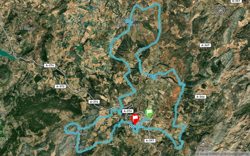


101.1 km
3120 m
3090 m
 Ronda (ES)
 Ronda (ES)
 Points of Interest table
| Accum. | Intermediary | |||||||
|---|---|---|---|---|---|---|---|---|
| POI | Description | Alt. | Dist. | D+ | D- | Dist. | D+ | D- |
 Competition organized on 05/11/2019
Trace n°72772
Ascent threshold : 3 m Distance threshold : 30 m Smoothing : Yes Origin of altitudes : MNT Aster GDEM
Ascent threshold : 3 m Distance threshold : 30 m Smoothing : Yes Origin of altitudes : MNT Aster GDEM
Crossing
Dominant terrain : Footpath
Max alti. : 910 m
Avg alti. : 678 m
Min alti. : 415 m
Longest ascent : 380 m
Longest descent : 590 m
Dominant terrain : Footpath
Max alti. : 910 m
Avg alti. : 678 m
Min alti. : 415 m
Longest ascent : 380 m
Longest descent : 590 m
Elevation profile
More tools
Create a new roadbook page
Map and track on your website
Warning ! When you insert a Trace de Trail map on your website, you agree not to hide any element of the module (links to Trail Trail or Trail Connect banner)
Add a realisation
Validate
Add a realisation to share your chrono and describe the conditions that you encountered during you trail running !
Add a comment
Validate
Admin - Trace de Trail
16/11/18, 21:45:53
Bonjour, Merci de nommer votre trace de manière à ce que la compétition puisse facilement être identifiée avant de la placer en public.
16/11/18, 21:45:53
Bonjour, Merci de nommer votre trace de manière à ce que la compétition puisse facilement être identifiée avant de la placer en public.
Show the infos
Add a track


