Show the map
Le Brûlé - Dos d'Âne - Le Bélier - Hell Bourg - Caverne Dufour - Plaine des Cafres - Plaine des Sabl
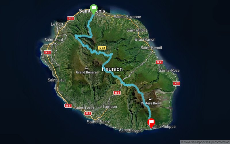


125.7 km
7090 m
7090 m
 Saint-Denis (RE)
 Saint-Philippe (RE)
 Points of Interest table
| Accum. | Intermediary | |||||||
|---|---|---|---|---|---|---|---|---|
| POI | Description | Alt. | Dist. | D+ | D- | Dist. | D+ | D- |
 Event off organized on 08/06/2018
Trace n°64902
Ascent threshold : 3 m Distance threshold : 30 m Smoothing : Yes Origin of altitudes : MNT IGN
Ascent threshold : 3 m Distance threshold : 30 m Smoothing : Yes Origin of altitudes : MNT IGN
Crossing
Dominant terrain : Footpath
Max alti. : 2493 m
Avg alti. : 1440 m
Min alti. : 39 m
Longest ascent : 1820 m
Longest descent : 2360 m
Dominant terrain : Footpath
Max alti. : 2493 m
Avg alti. : 1440 m
Min alti. : 39 m
Longest ascent : 1820 m
Longest descent : 2360 m
Elevation profile
More tools
Create a new roadbook page
Map and track on your website
Warning ! When you insert a Trace de Trail map on your website, you agree not to hide any element of the module (links to Trail Trail or Trail Connect banner)
Add a realisation
Validate
Add a realisation to share your chrono and describe the conditions that you encountered during you trail running !
Add a comment
Validate
Show the infos
Add a track


