Show the map
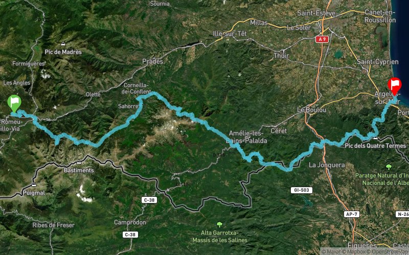
Coll Mija - Vernet-les-Bains - Arles-sur-Tech - Roc de France - Plage des Pins


166 km
8690 m
10430 m
 Bolquère (66)
 Argelès-sur-Mer (66)
 Points of Interest table
| Accum. | Intermediary | |||||||
|---|---|---|---|---|---|---|---|---|
| POI | Description | Alt. | Dist. | D+ | D- | Dist. | D+ | D- |
Trace n°62043
Ascent threshold : 3 m Distance threshold : 30 m Smoothing : No Origin of altitudes : MNT Aster GDEM
Ascent threshold : 3 m Distance threshold : 30 m Smoothing : No Origin of altitudes : MNT Aster GDEM
Crossing
Dominant terrain : Footpath
Max alti. : 2374 m
Avg alti. : 1126 m
Min alti. : 4 m
Longest ascent : 1680 m
Longest descent : 1590 m
Route completed by the author : No
Dominant terrain : Footpath
Max alti. : 2374 m
Avg alti. : 1126 m
Min alti. : 4 m
Longest ascent : 1680 m
Longest descent : 1590 m
Route completed by the author : No
Elevation profile
More tools
Create a new roadbook page
Map and track on your website
Warning ! When you insert a Trace de Trail map on your website, you agree not to hide any element of the module (links to Trail Trail or Trail Connect banner)
Add a realisation
Validate
Add a realisation to share your chrono and describe the conditions that you encountered during you trail running !
Add a comment
Validate
Show the infos
Add a track


