Show the map
Evaluated Track - ITRA
Qinling International Trail 2018 - UTMQ
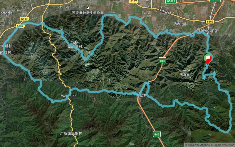


102.6 km
6080 m
6080 m
 Xian Shi (CN)
 8
8 320
320 Points of Interest table
| Accum. | Intermediary | |||||||
|---|---|---|---|---|---|---|---|---|
| POI | Description | Alt. | Dist. | D+ | D- | Dist. | D+ | D- |
 Competition organized on 06/02/2018
Trace n°59508
Ascent threshold : 10 m Distance threshold : 0 m Smoothing : No Origin of altitudes :
Ascent threshold : 10 m Distance threshold : 0 m Smoothing : No Origin of altitudes :
Loop
Dominant terrain : Path
Max alti. : 2539 m
Avg alti. : 1130 m
Min alti. : 464 m
Longest ascent : 1410 m
Longest descent : 1160 m
Dominant terrain : Path
Max alti. : 2539 m
Avg alti. : 1130 m
Min alti. : 464 m
Longest ascent : 1410 m
Longest descent : 1160 m
Elevation profile
More tools
Create a new roadbook page
Map and track on your website
Warning ! When you insert a Trace de Trail map on your website, you agree not to hide any element of the module (links to Trail Trail or Trail Connect banner)
Add a realisation
Validate
Add a realisation to share your chrono and describe the conditions that you encountered during you trail running !
Add a comment
Validate
Admin - Trace de Trail
21/05/18, 20:40:20
Bonjour, Merci de classer votre trace en compétition avant de la placer en public.
21/05/18, 20:40:20
Bonjour, Merci de classer votre trace en compétition avant de la placer en public.
Show the infos
Add a track


