Show the map
Evaluated Track - ITRA
Trail Côte d'Opale 2018 - 42 km
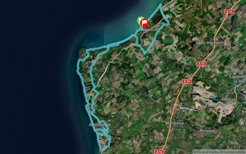


 Wissant (62)
 Wissant (62)

Points of Interest table
| Accum. | Intermediary | |||||||
|---|---|---|---|---|---|---|---|---|
| POI | Description | Alt. | Dist. | D+ | D- | Dist. | D+ | D- |
 Competition organized on 09/09/2018
Trace n°55398
Ascent threshold : 0 m Distance threshold : 30 m Smoothing : Yes Origin of altitudes : MNT IGN
Ascent threshold : 0 m Distance threshold : 30 m Smoothing : Yes Origin of altitudes : MNT IGN
Loop
Dominant terrain : Footpath
Max alti. : 63 m
Avg alti. : 21 m
Min alti. : 1 m
Longest ascent : 80 m
Longest descent : 80 m
Dominant terrain : Footpath
Max alti. : 63 m
Avg alti. : 21 m
Min alti. : 1 m
Longest ascent : 80 m
Longest descent : 80 m
Elevation profile
More tools
Create a new roadbook page
Map and track on your website
Warning ! When you insert a Trace de Trail map on your website, you agree not to hide any element of the module (links to Trail Trail or Trail Connect banner)
Add a realisation
Validate
Add a realisation to share your chrono and describe the conditions that you encountered during you trail running !
Add a comment
Validate
Akim Demora
16/08/18, 20:43:17
Ravito au 21,5 et 40km. MATERIEL OBLIGATOIRE : Gourde ou Camel Bag + Coupe vent ou Couverture de Survie ?+ gobelet DIFFICULTES DANS L’ORDRE Plage de Wissant Les Combles de Sombre Mont Aux Leux Dunes de la Slack Contournement de la Slack Falaises de Audresselles au Cap Gris Nez Dunes de Chatelet ??
Show the infos
Add a track


