Show the map
Certified Track - ITRA
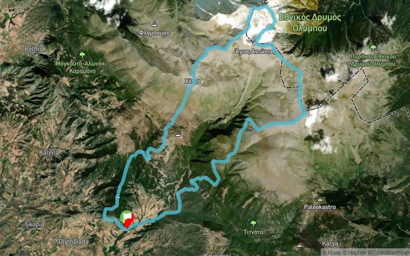
Zeus Free Sky Running 2018


 Falani (GR)


You will start in the dark with your head light.
You will climb 1200m in 3km to the first day light.
You will encounter your strength in the highest "sky-road" of Greece, in the narrow peaks of Olympus mountain. Your guide will be ZEUS
Points of Interest table
| Accum. | Intermediary | |||||||
|---|---|---|---|---|---|---|---|---|
| POI | Description | Alt. | Dist. | D+ | D- | Dist. | D+ | D- |
 Competition organized on 08/05/2018
Trace n°54613
Ascent threshold : 3 m Distance threshold : 0 m Smoothing : No Origin of altitudes : GPS + MNT Aster GDEM
Ascent threshold : 3 m Distance threshold : 0 m Smoothing : No Origin of altitudes : GPS + MNT Aster GDEM
Loop
Dominant terrain : Footpath
Max alti. : 2884 m
Avg alti. : 1758 m
Min alti. : 573 m
Longest ascent : 2220 m
Longest descent : 2080 m
Dominant terrain : Footpath
Max alti. : 2884 m
Avg alti. : 1758 m
Min alti. : 573 m
Longest ascent : 2220 m
Longest descent : 2080 m
Elevation profile
More tools
Create a new roadbook page
Map and track on your website
Warning ! When you insert a Trace de Trail map on your website, you agree not to hide any element of the module (links to Trail Trail or Trail Connect banner)
Add a realisation
Validate
Add a realisation to share your chrono and describe the conditions that you encountered during you trail running !
Add a comment
Validate
Show the infos
Add a track


