Show the map
Evaluated Track - ITRA
Desafío Estrecho de Las Hoces 2018
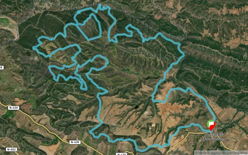


 Puebla De Don Rodrigo (ES)


100km Ultra Trail through the municipality of Puebla de Don Rodrigo, located between the Cabañeros National Park and the Valle de Alcudia Natural Park. An inhospitable and unpopulated area, without mobile coverage in 80% of the route, a continuous ups and downs will make this challenge a reunion with oneself.
Points of Interest table
| Accum. | Intermediary | |||||||
|---|---|---|---|---|---|---|---|---|
| POI | Description | Alt. | Dist. | D+ | D- | Dist. | D+ | D- |
 Competition organized on 05/26/2018
Trace n°51973
Ascent threshold : 3 m Distance threshold : 30 m Smoothing : Yes Origin of altitudes : MNT Google
Ascent threshold : 3 m Distance threshold : 30 m Smoothing : Yes Origin of altitudes : MNT Google
Loop
Dominant terrain : Path
Max alti. : 857 m
Avg alti. : 635 m
Min alti. : 431 m
Longest ascent : 420 m
Longest descent : 340 m
Dominant terrain : Path
Max alti. : 857 m
Avg alti. : 635 m
Min alti. : 431 m
Longest ascent : 420 m
Longest descent : 340 m
Elevation profile
More tools
Create a new roadbook page
Map and track on your website
Warning ! When you insert a Trace de Trail map on your website, you agree not to hide any element of the module (links to Trail Trail or Trail Connect banner)
Add a realisation
Validate
Add a realisation to share your chrono and describe the conditions that you encountered during you trail running !
Add a comment
Validate
Show the infos
Add a track


