Show the map
Trail de la Factrice 2017
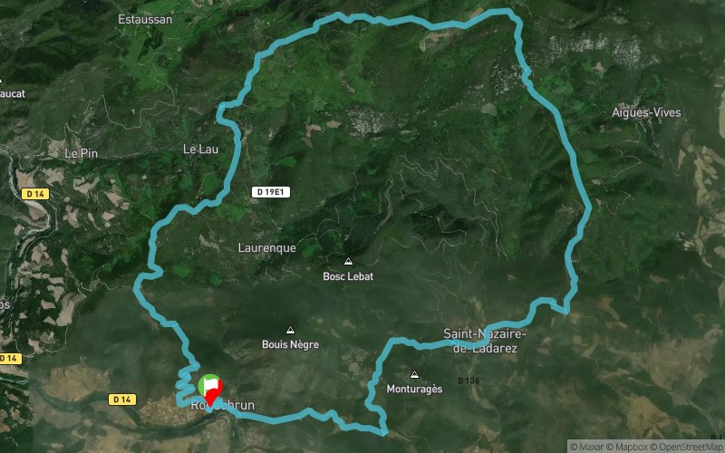


26.6 km
1110 m
1110 m
 Roquebrun (34)
 Points of Interest table
| Accum. | Intermediary | |||||||
|---|---|---|---|---|---|---|---|---|
| POI | Description | Alt. | Dist. | D+ | D- | Dist. | D+ | D- |
 Competition organized on 06/03/2017
Trace n°49215
Ascent threshold : 3 m Distance threshold : 30 m Smoothing : Yes Origin of altitudes : MNT Aster GDEM
Ascent threshold : 3 m Distance threshold : 30 m Smoothing : Yes Origin of altitudes : MNT Aster GDEM
Loop
Dominant terrain : Path
Max alti. : 640 m
Avg alti. : 384 m
Min alti. : 74 m
Longest ascent : 500 m
Longest descent : 530 m
Dominant terrain : Path
Max alti. : 640 m
Avg alti. : 384 m
Min alti. : 74 m
Longest ascent : 500 m
Longest descent : 530 m
Elevation profile
More tools
Create a new roadbook page
Map and track on your website
Warning ! When you insert a Trace de Trail map on your website, you agree not to hide any element of the module (links to Trail Trail or Trail Connect banner)
Add a realisation
Validate
Add a realisation to share your chrono and describe the conditions that you encountered during you trail running !
Add a comment
Validate
Traileur Avignon
06/09/20, 22:33:26
Super trace, en grande partie en sous bois avec beaucoup d'ombre. C'est assez bien balisé
06/09/20, 22:33:26
Super trace, en grande partie en sous bois avec beaucoup d'ombre. C'est assez bien balisé
Admin - Trace de Trail
17/12/17, 23:40:33
Bonjour, Merci de classer votre trace en compétition avant de la placer en public.
17/12/17, 23:40:33
Bonjour, Merci de classer votre trace en compétition avant de la placer en public.
Show the infos
Add a track


