Show the map
Happlincourt - Montagne de Salency - Mont St-Siméon - Landrimont
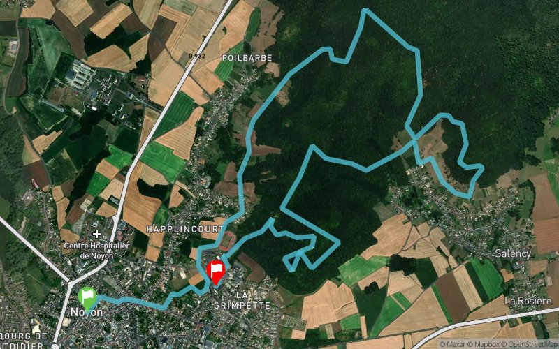


14.4 km
370 m
360 m
 Noyon (60)
 Noyon (60)
 Points of Interest table
| Accum. | Intermediary | |||||||
|---|---|---|---|---|---|---|---|---|
| POI | Description | Alt. | Dist. | D+ | D- | Dist. | D+ | D- |
Trace n°49104
Ascent threshold : 3 m Distance threshold : 30 m Smoothing : Yes Origin of altitudes : MNT Aster GDEM
Ascent threshold : 3 m Distance threshold : 30 m Smoothing : Yes Origin of altitudes : MNT Aster GDEM
Crossing
Dominant terrain : Path
Max alti. : 183 m
Avg alti. : 119 m
Min alti. : 41 m
Longest ascent : 160 m
Longest descent : 110 m
Route completed by the author : nc
Dominant terrain : Path
Max alti. : 183 m
Avg alti. : 119 m
Min alti. : 41 m
Longest ascent : 160 m
Longest descent : 110 m
Route completed by the author : nc
Elevation profile
More tools
Create a new roadbook page
Map and track on your website
Warning ! When you insert a Trace de Trail map on your website, you agree not to hide any element of the module (links to Trail Trail or Trail Connect banner)
Add a realisation
Validate
Add a realisation to share your chrono and describe the conditions that you encountered during you trail running !
Add a comment
Validate
Admin - Trace de Trail
14/12/17, 22:29:33
Bonjour, Merci de classer votre trace en compétition avant de la placer en publique.
14/12/17, 22:29:33
Bonjour, Merci de classer votre trace en compétition avant de la placer en publique.
Show the infos
Add a track


