Show the map
Evaluated Track - ITRA
Winchcombe Cross 2018 - 50M


 Winchcombe (GB)
 Winchcombe (GB)


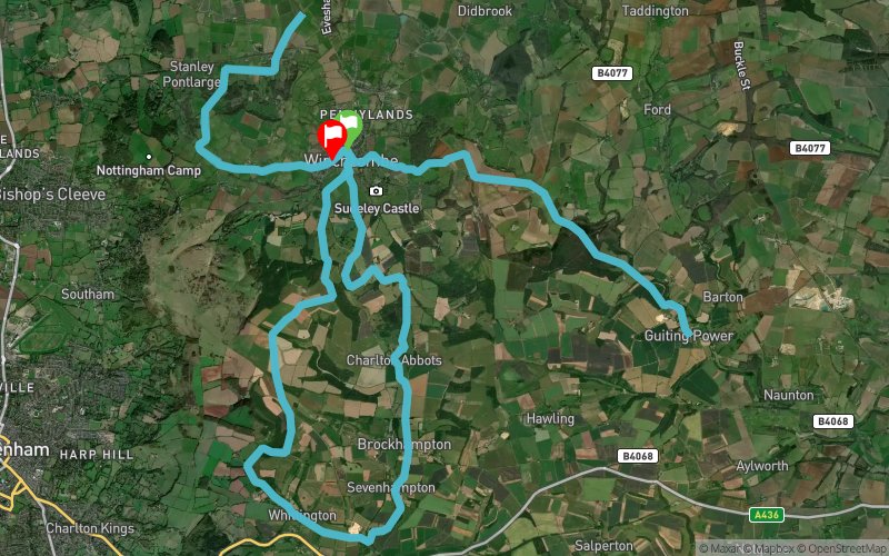
Complete route map for the Winchcombe Cross 50mi race. The map does not necessarily follow the out & back order that will be used on race day, but does follow the actual route.
Points of Interest table
| Accum. | Intermediary | |||||||
|---|---|---|---|---|---|---|---|---|
| POI | Description | Alt. | Dist. | D+ | D- | Dist. | D+ | D- |
 Competition organized on 05/06/2018
Trace n°48278
Ascent threshold : 10 m Distance threshold : 0 m Smoothing : No Origin of altitudes : GPS
Ascent threshold : 10 m Distance threshold : 0 m Smoothing : No Origin of altitudes : GPS
Loop
Dominant terrain : Footpath
Max alti. : 303 m
Avg alti. : 185 m
Min alti. : 63 m
Longest ascent : 220 m
Longest descent : 210 m
Dominant terrain : Footpath
Max alti. : 303 m
Avg alti. : 185 m
Min alti. : 63 m
Longest ascent : 220 m
Longest descent : 210 m
Elevation profile
More tools
Create a new roadbook page
Map and track on your website
Warning ! When you insert a Trace de Trail map on your website, you agree not to hide any element of the module (links to Trail Trail or Trail Connect banner)
Add a realisation
Validate
Add a realisation to share your chrono and describe the conditions that you encountered during you trail running !
Add a comment
Validate
Show the infos
Add a track


