Show the map
Lac de Charance - Les Freyssets
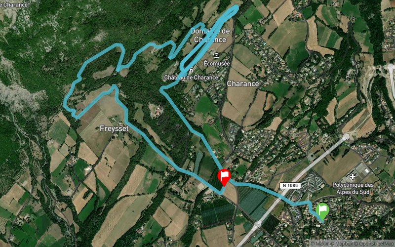


11.3 km
457 m
405 m
 Gap (05)
 Gap (05)
 Points of Interest table
| Accum. | Intermediary | |||||||
|---|---|---|---|---|---|---|---|---|
| POI | Description | Alt. | Dist. | D+ | D- | Dist. | D+ | D- |
Trace n°4709
Ascent threshold : 0 m Distance threshold : 35 m Smoothing : Yes Origin of altitudes : MNT Aster GDEM
Ascent threshold : 0 m Distance threshold : 35 m Smoothing : Yes Origin of altitudes : MNT Aster GDEM
Crossing
Dominant terrain : Footpath
Max alti. : 1221 m
Avg alti. : 1045 m
Min alti. : 849 m
Longest ascent : 450 m
Longest descent : 337 m
Route completed by the author : nc
Dominant terrain : Footpath
Max alti. : 1221 m
Avg alti. : 1045 m
Min alti. : 849 m
Longest ascent : 450 m
Longest descent : 337 m
Route completed by the author : nc
Elevation profile
More tools
Create a new roadbook page
Map and track on your website
Warning ! When you insert a Trace de Trail map on your website, you agree not to hide any element of the module (links to Trail Trail or Trail Connect banner)
Add a realisation
Validate
Add a realisation to share your chrono and describe the conditions that you encountered during you trail running !
Add a comment
Validate
catoby
07/04/17, 08:12:22
Bonjour , Merci pour la trace, un endroit très joli que je ne connaissais pas... Je suis monté un peu vers la brêche jusqu'à un joli point de vue, je reviendrai pour monter plus haut ...
07/04/17, 08:12:22
Bonjour , Merci pour la trace, un endroit très joli que je ne connaissais pas... Je suis monté un peu vers la brêche jusqu'à un joli point de vue, je reviendrai pour monter plus haut ...
Show the infos
Add a track


