Show the map
Certified Track - ITRA
Techni'trail De Tiranges 2018 - TTT 50 km
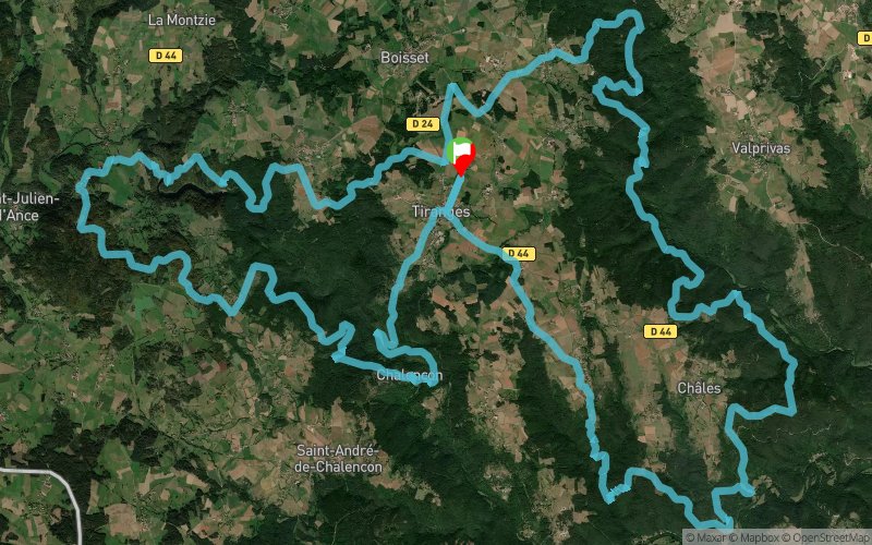


 Tiranges (43)


This course is very demanding as much on the difference in level as on the regular sequence of very technical parts. Some stretches will make it possible to revive. The runners will take the wild valley of Andrable passing by the jump of the Bezan before arriving at the lava flow of Bourrianne which must be climbed in the middle then to the medieval castle of Chalencon. There are four refueling points on the route, which offer a total positive drop of +3,100 meters. The companions can find the GPS coordinates on the site of the TTT as well as those places where it is possible to see the runners pass.
Points of Interest table
| Accum. | Intermediary | |||||||
|---|---|---|---|---|---|---|---|---|
| POI | Description | Alt. | Dist. | D+ | D- | Dist. | D+ | D- |
 Competition organized on 05/06/2018
Trace n°43196
Ascent threshold : 3 m Distance threshold : 20 m Smoothing : Yes Origin of altitudes : MNT IGN
Ascent threshold : 3 m Distance threshold : 20 m Smoothing : Yes Origin of altitudes : MNT IGN
Loop
Dominant terrain : Footpath
Max alti. : 932 m
Avg alti. : 746 m
Min alti. : 504 m
Longest ascent : 280 m
Longest descent : 300 m
Dominant terrain : Footpath
Max alti. : 932 m
Avg alti. : 746 m
Min alti. : 504 m
Longest ascent : 280 m
Longest descent : 300 m
Elevation profile
More tools
Create a new roadbook page
Map and track on your website
Warning ! When you insert a Trace de Trail map on your website, you agree not to hide any element of the module (links to Trail Trail or Trail Connect banner)
Add a realisation
Validate
Add a realisation to share your chrono and describe the conditions that you encountered during you trail running !
Add a comment
Validate
Show the infos
Add a track


