Show the map
Certified Track - ITRA
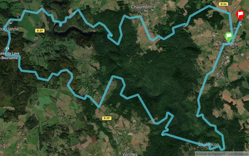
Techni'trail de Tiranges 2018 - TTT 24 km


 Tiranges (43)
 Tiranges (43)


It is also a demanding journey during which the technical parts and the more rolling paths succeed one another. The runners will take the famous lava flow of Bourrianne before arriving at the medieval castle of Chalencon. Two refreshments are planned on this route totaling a positive drop of + 1476 meters in the heart of exceptional landscapes. Their GPS coordinates as well as those of places where it is possible to see runners will be available on the site of the TTT.
Points of Interest table
| Accum. | Intermediary | |||||||
|---|---|---|---|---|---|---|---|---|
| POI | Description | Alt. | Dist. | D+ | D- | Dist. | D+ | D- |
 Competition organized on 05/06/2018
Trace n°43047
Ascent threshold : 3 m Distance threshold : 0 m Smoothing : No Origin of altitudes : GPS
Ascent threshold : 3 m Distance threshold : 0 m Smoothing : No Origin of altitudes : GPS
Loop
Dominant terrain : Footpath
Max alti. : 894 m
Avg alti. : 760 m
Min alti. : 575 m
Longest ascent : 200 m
Longest descent : 240 m
Dominant terrain : Footpath
Max alti. : 894 m
Avg alti. : 760 m
Min alti. : 575 m
Longest ascent : 200 m
Longest descent : 240 m
Elevation profile
More tools
Create a new roadbook page
Map and track on your website
Warning ! When you insert a Trace de Trail map on your website, you agree not to hide any element of the module (links to Trail Trail or Trail Connect banner)
Add a realisation
Validate
Add a realisation to share your chrono and describe the conditions that you encountered during you trail running !
Add a comment
Validate
Show the infos
Add a track


