Show the map
Evaluated Track - ITRA
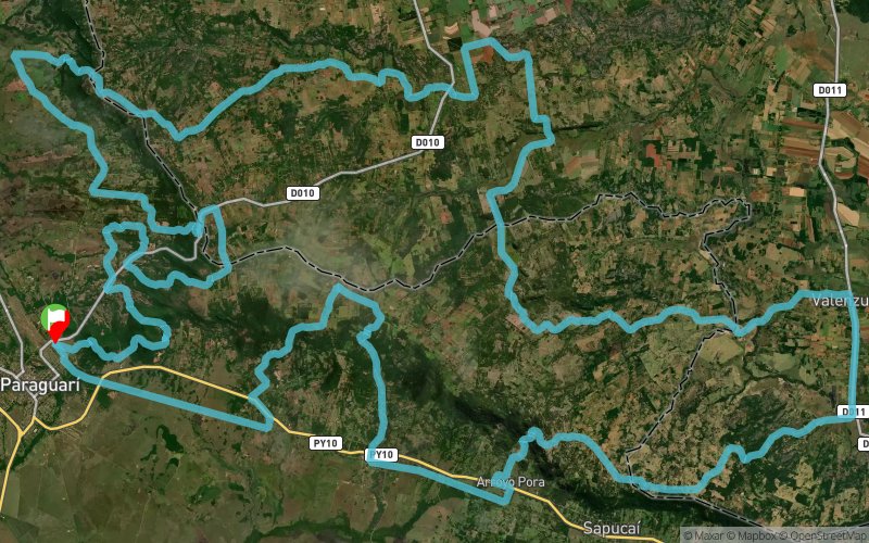
Ultratrail Arasunu 2017


 Inconnu (PY)


The UltraTrail "Alma Guaraní" Arasunu 2017 is an ultramarathon race of medium and long distance competitive that consists of crossing a marked route of 21, 42, 80 and 140 kilometers of length approximately and with limit of stipulated time to cross the goal.
It will be developed in Paraguay in the Paraguarí Department, encompassing the cities of Paraguarí, Piribebuy, Escobar, Sapucai, Caballero, Yaguaron.
We emphasize that this 4th edition of Ultratrail race has one of the most difficult routes currently.
The race will be characterized by continuous unevenness.
Arasunu is the first organization to include within the 140km route two stretches of zip line inside the Mbatovi reservation.
UTA 2017 is organized by the sports group ARASUNU ECOAVENTURA TEAM, current member of the International Trail Running Association ITRA.
Points of Interest table
| Accum. | Intermediary | |||||||
|---|---|---|---|---|---|---|---|---|
| POI | Description | Alt. | Dist. | D+ | D- | Dist. | D+ | D- |
 Competition organized on 09/09/2017
Trace n°41597
Ascent threshold : 3 m Distance threshold : 30 m Smoothing : Yes Origin of altitudes : MNT Google
Ascent threshold : 3 m Distance threshold : 30 m Smoothing : Yes Origin of altitudes : MNT Google
Loop
Dominant terrain : Footpath
Max alti. : 421 m
Avg alti. : 229 m
Min alti. : 115 m
Longest ascent : 330 m
Longest descent : 330 m
Dominant terrain : Footpath
Max alti. : 421 m
Avg alti. : 229 m
Min alti. : 115 m
Longest ascent : 330 m
Longest descent : 330 m
Elevation profile
More tools
Create a new roadbook page
Map and track on your website
Warning ! When you insert a Trace de Trail map on your website, you agree not to hide any element of the module (links to Trail Trail or Trail Connect banner)
Add a realisation
Validate
Add a realisation to share your chrono and describe the conditions that you encountered during you trail running !
Add a comment
Validate
Show the infos
Add a track


