Show the map
Dury - Bois de la Belle Épine
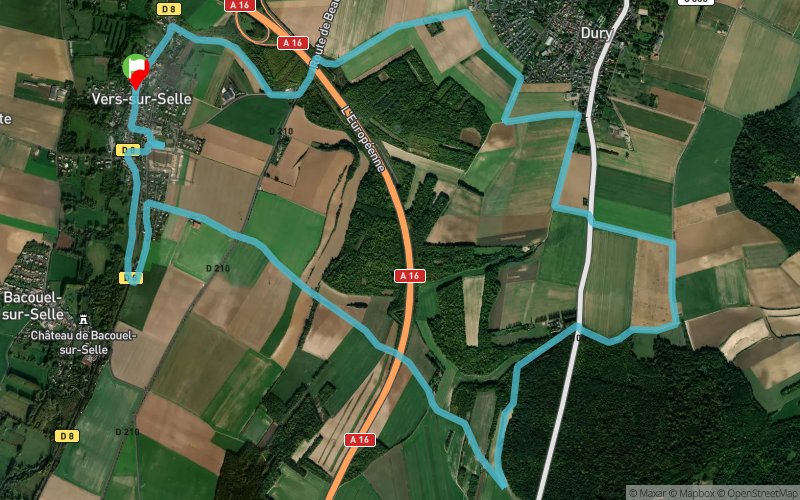


 Vers-sur-Selles (80)
 Points of Interest table
| Accum. | Intermediary | |||||||
|---|---|---|---|---|---|---|---|---|
| POI | Description | Alt. | Dist. | D+ | D- | Dist. | D+ | D- |
Trace n°40194
Ascent threshold : 3 m Distance threshold : 30 m Smoothing : Yes Origin of altitudes : MNT Aster GDEM
Ascent threshold : 3 m Distance threshold : 30 m Smoothing : Yes Origin of altitudes : MNT Aster GDEM
Loop
Dominant terrain : Path
Max alti. : 125 m
Avg alti. : 73 m
Min alti. : 26 m
Longest ascent : 80 m
Longest descent : 70 m
Route completed by the author : nc
Dominant terrain : Path
Max alti. : 125 m
Avg alti. : 73 m
Min alti. : 26 m
Longest ascent : 80 m
Longest descent : 70 m
Route completed by the author : nc
Elevation profile
More tools
Create a new roadbook page
Map and track on your website
Warning ! When you insert a Trace de Trail map on your website, you agree not to hide any element of the module (links to Trail Trail or Trail Connect banner)
Add a realisation
Validate
Add a realisation to share your chrono and describe the conditions that you encountered during you trail running !
Add a comment
Validate
Eloi Nauwynck
29/01/20, 23:54:07
Marquage inexistant lors de mon passage. Une route nationale à traverser 2 fois.. au heure de pointe pas forcément évident..
29/01/20, 23:54:07
Marquage inexistant lors de mon passage. Une route nationale à traverser 2 fois.. au heure de pointe pas forcément évident..
Show the infos
Add a track


