Show the map
Evaluated Track - ITRA
Sky Ultra Pico Mx 2017 - 50K
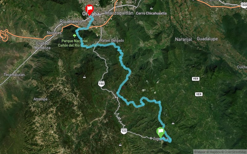


 Zongolica (MX)
 Orizaba (MX)


This Trail race will serve to measure you and as a background for you in 2018 you get excited and meet the requirements to participate in the Sky Ultra Pico Mx 130 K.
The trail will take you to the mountain through the magic route of the Zongolica Mountain, passing through the municipalities of Tequila, Magdalena, Rafael Delgado, Tlilapan, and Huiloapan to reach the goal Located in Bicentennial Square of Orizaba.
The accumulated positive slope is D + 2960m and the negative D-2950m.
Points of Interest table
| Accum. | Intermediary | |||||||
|---|---|---|---|---|---|---|---|---|
| POI | Description | Alt. | Dist. | D+ | D- | Dist. | D+ | D- |
 Competition organized on 12/02/2017
Trace n°39761
Ascent threshold : 10 m Distance threshold : 0 m Smoothing : No Origin of altitudes : GPS
Ascent threshold : 10 m Distance threshold : 0 m Smoothing : No Origin of altitudes : GPS
Crossing
Dominant terrain : Path
Max alti. : 1924 m
Avg alti. : 1427 m
Min alti. : 984 m
Longest ascent : 940 m
Longest descent : 550 m
Dominant terrain : Path
Max alti. : 1924 m
Avg alti. : 1427 m
Min alti. : 984 m
Longest ascent : 940 m
Longest descent : 550 m
Elevation profile
More tools
Create a new roadbook page
Map and track on your website
Warning ! When you insert a Trace de Trail map on your website, you agree not to hide any element of the module (links to Trail Trail or Trail Connect banner)
Add a realisation
Validate
Add a realisation to share your chrono and describe the conditions that you encountered during you trail running !
Add a comment
Validate
Show the infos
Add a track


