Show the map
Bionnassay - Col de Tricot - Ref. de Plan Glacier
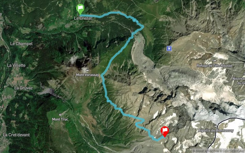


9.5 km
1571 m
324 m
 Les Houches (74)
 Les Contamines-Montjoie (74)
 Points of Interest table
| Accum. | Intermediary | |||||||
|---|---|---|---|---|---|---|---|---|
| POI | Description | Alt. | Dist. | D+ | D- | Dist. | D+ | D- |
Trace n°3827
Ascent threshold : 0 m Distance threshold : 35 m Smoothing : Yes Origin of altitudes : MNT Aster GDEM
Ascent threshold : 0 m Distance threshold : 35 m Smoothing : Yes Origin of altitudes : MNT Aster GDEM
Crossing
Dominant terrain : Footpath
Max alti. : 2684 m
Avg alti. : 2029 m
Min alti. : 1422 m
Longest ascent : 420 m
Longest descent : 133 m
Route completed by the author : nc
Dominant terrain : Footpath
Max alti. : 2684 m
Avg alti. : 2029 m
Min alti. : 1422 m
Longest ascent : 420 m
Longest descent : 133 m
Route completed by the author : nc
Elevation profile
More tools
Create a new roadbook page
Map and track on your website
Warning ! When you insert a Trace de Trail map on your website, you agree not to hide any element of the module (links to Trail Trail or Trail Connect banner)
Add a realisation
Validate
Add a realisation to share your chrono and describe the conditions that you encountered during you trail running !
Add a comment
Validate
PHILEG
29/07/14, 18:11:07
trajet tranquille en 4h30 et 2h06 jusqu'au col du tricot
29/07/14, 18:11:07
trajet tranquille en 4h30 et 2h06 jusqu'au col du tricot
du col au refuge plan glacier, partie à réserver au marcheurs/coureurs habitués à la haute montagne (vertige ???)
Show the infos
Add a track


