Show the map
OFFICIAL ROUTE
Course du Cabaliros 2017
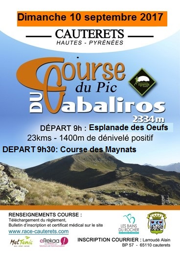


 Cauterets (65)

Points of Interest table
| Accum. | Intermediary | |||||||
|---|---|---|---|---|---|---|---|---|
| POI | Description | Alt. | Dist. | D+ | D- | Dist. | D+ | D- |
 Competition organized on 09/10/2017
Trace n°37605
Ascent threshold : 0 m Distance threshold : 30 m Smoothing : Yes Origin of altitudes : MNT IGN
Ascent threshold : 0 m Distance threshold : 30 m Smoothing : Yes Origin of altitudes : MNT IGN
Loop
Dominant terrain : Footpath
Max alti. : 2150 m
Avg alti. : 1531 m
Min alti. : 922 m
Longest ascent : 1280 m
Longest descent : 1240 m
Dominant terrain : Footpath
Max alti. : 2150 m
Avg alti. : 1531 m
Min alti. : 922 m
Longest ascent : 1280 m
Longest descent : 1240 m
Elevation profile
More tools
Create a new roadbook page
Map and track on your website
Warning ! When you insert a Trace de Trail map on your website, you agree not to hide any element of the module (links to Trail Trail or Trail Connect banner)
Add a realisation
Validate
Add a realisation to share your chrono and describe the conditions that you encountered during you trail running !
Add a comment
Validate
Admin - Trace de Trail
18/05/17, 20:29:34
Bonjour, Merci d'utiliser le nom de la compétition pour nommer votre trace avant de la placer en publique.
18/05/17, 20:29:34
Bonjour, Merci d'utiliser le nom de la compétition pour nommer votre trace avant de la placer en publique.
Show the infos
Add a track


