Show the map
Evaluated Track - ITRA
Ultra Fatra 2017
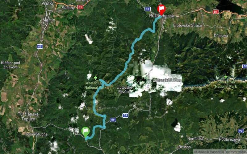


 Harmanec (SK)
 Malinô Brdo (SK)


Ultra Fatra is one of the extreme running events in Slovakia, the ultra trail category. Race route runs through the highest peaks, mountain meadows, rocky cliffs of nature reserve National Park Ve?ká Fatra. Granted, you will experience an unforgettable feeling of wilderness.
Points of Interest table
| Accum. | Intermediary | |||||||
|---|---|---|---|---|---|---|---|---|
| POI | Description | Alt. | Dist. | D+ | D- | Dist. | D+ | D- |
 Competition organized on 07/29/2017
Trace n°34468
Ascent threshold : 3 m Distance threshold : 30 m Smoothing : Yes Origin of altitudes : MNT Google
Ascent threshold : 3 m Distance threshold : 30 m Smoothing : Yes Origin of altitudes : MNT Google
Crossing
Dominant terrain : Footpath
Max alti. : 1578 m
Avg alti. : 1168 m
Min alti. : 479 m
Longest ascent : 1240 m
Longest descent : 650 m
Dominant terrain : Footpath
Max alti. : 1578 m
Avg alti. : 1168 m
Min alti. : 479 m
Longest ascent : 1240 m
Longest descent : 650 m
Elevation profile
More tools
Create a new roadbook page
Map and track on your website
Warning ! When you insert a Trace de Trail map on your website, you agree not to hide any element of the module (links to Trail Trail or Trail Connect banner)
Add a realisation
Validate
Add a realisation to share your chrono and describe the conditions that you encountered during you trail running !
Add a comment
Validate
Show the infos
Add a track


